 JamJumper
- All USA ›
- All West: 11,195 cams ›
- California2,660
- Utah2,063
- Washington1,470
- Colorado1,348
- Wyoming764
- Oregon714
- Arizona587
- Nevada526
- Idaho446
- Montana429
- New Mexico169
- Alaska19
Traffic cams around the San Francisco Bay Area from Caltrans: I-80 and the Bay Bridge, I-580, I-880, I-680, I-280, US-101, SR-4, SR-24, SR-84, SR-85 and SR-92
U.S. Highway 101 · Windsor, CA
Windsor - US-101 northbound at Shiloh Rd, Windsor - View north - MM 496.1 104 ft

U.S. Highway 101 · Larkfield-Wikiup, CA
Larkfield-Wikiup - US-101 southbound at Donna Dr, Larkfield-Wikiup - View south 111 ft

U.S. Highway 101 · Larkfield-Wikiup, CA
Larkfield-Wikiup - US-101 southbound south of River Road, Larkfield-Wikiup - View south - MM 492.45 150 ft

U.S. Highway 101 · Santa Rosa, CA
Santa Rosa - US-101 northbound at Bicentennial WAY, Santa Rosa - View north 147 ft

U.S. Highway 101 · Santa Rosa, CA
Santa Rosa - US-101 southbound at College Avenue, Santa Rosa - View south - MM 489.19 160 ft

U.S. Highway 101 · Santa Rosa, CA
Santa Rosa - US-101 southbound at Baker Ave, Santa Rosa - View south - MM 487.184 144 ft

U.S. Highway 101 · Santa Rosa, CA
Santa Rosa - US-101 southbound at Todd Road, Santa Rosa - View south - MM 484.877 111 ft

U.S. Highway 101 · Rohnert Park, CA
Rohnert Park - US-101 southbound at Before Wilfred Ave, Rohnert Park - View south 91 ft

U.S. Highway 101 · Rohnert Park, CA
Rohnert Park - US-101 northbound at Aaron St, Rohnert Park - View north 104 ft
U.S. Highway 101 · Cotati, CA
Cotati - US-101 southbound at SR-116, Cotati - View south - MM 481.18 104 ft

U.S. Highway 101 · Cotati, CA
Cotati - US-101 northbound at NOF W Railroad Ave, Cotati - View north - MM 479.261 314 ft

U.S. Highway 101 · Petaluma, CA
Petaluma - US-101 northbound north of Petaluma Blvd, Petaluma - View north - MM 476.15 29 ft

U.S. Highway 101 · Petaluma, CA
Petaluma - US-101 southbound at NOF E Washington St, Petaluma - View south 22 ft

U.S. Highway 101 · Petaluma, CA
Petaluma - US-101 southbound at SOF Petaluma Blvd, Petaluma - View south 22 ft

U.S. Highway 101 · Petaluma, CA
Petaluma - US-101 southbound at SR-116, Petaluma - View south - MM 472.28 3 ft

U.S. Highway 101 · Petaluma, CA
Petaluma - US-101 northbound at Tunzi Road, Petaluma - View north - MM 470.09 82 ft

U.S. Highway 101 · Novato, CA
Novato - US-101 southbound at Atherton Ave, Novato - View south - MM 462.857 16 ft

U.S. Highway 101 · Novato, CA
Novato - US-101 northbound at DE Long Ave, Novato - View north - MM 461.991 32 ft

U.S. Highway 101 · Novato, CA
Novato - US-101 southbound at Rowland Blvd, Novato - View south 13 ft

U.S. Highway 101 · Novato, CA
Novato - US-101 southbound at Ignacio Blvd, Novato - View south - MM 459.03 22 ft

U.S. Highway 101 · San Rafael, CA
San Rafael - US-101 southbound just north of Lincoln Ave, San Rafael - View south - MM 453.51 157 ft
U.S. Highway 101 · San Rafael, CA
San Rafael - US-101 northbound just north of Central SRF, San Rafael - View north - MM 452.158 52 ft

U.S. Highway 101 · San Rafael, CA
San Rafael - US-101 eastbound at I-580, San Rafael - View east - MM 450.97 3 ft
U.S. Highway 101 · Larkspur, CA
Larkspur - US-101 southbound just north of Greenbrae PED overcrossing, Larkspur - View south - MM 449.153 6 ft

U.S. Highway 101 · Tamalpais-Homestead Valley, CA
Tamalpais-Homestead Valley - US-101 southbound at Marin SR-1, Tamalpais-Homestead Valley - View south - MM 445.26
U.S. Highway 101 · Marin City, CA
Marin City - US-101 northbound at Marin City off-ramp, Marin City - View north - MM 444.227 19 ft

U.S. Highway 101 · Sausalito, CA
Sausalito - US-101 northbound at Spencer Avenue, Sausalito - View north - MM 442.51 623 ft

U.S. Highway 101 · Sausalito, CA
Sausalito - US-101 southbound at Sausalito Road Undercross, Sausalito - View south - MM 441.26 285 ft
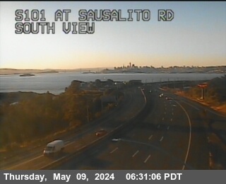
U.S. Highway 101 · Sausalito, CA
Sausalito - US-101 northbound at Bowers Vista Point, Sausalito - View north - MM 441.08 209 ft
U.S. Highway 101 · Sausalito, CA
Sausalito - US-101 northbound at Bowers Vista Point Exit, Sausalito - View north 183 ft
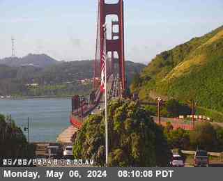
U.S. Highway 101 · Sausalito, CA
Sausalito - US-101 northbound at Bowers Vista Point Parking, Sausalito - View north 203 ft
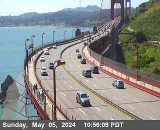
U.S. Highway 101 · San Francisco, CA
San Francisco - US-101 southbound at Octavia St, San Francisco - View south - MM 433.72 65 ft
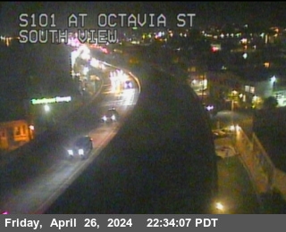
U.S. Highway 101 · San Francisco, CA
San Francisco - US-101 southbound at 17th Street, San Francisco - View south - MM 432.4 91 ft

U.S. Highway 101 · San Francisco, CA
San Francisco - US-101 southbound at Hospital Curve, San Francisco - View south - MM 432.06 88 ft
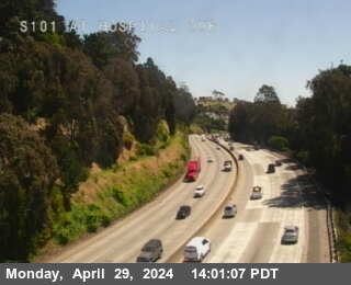
U.S. Highway 101 · San Francisco, CA
San Francisco - US-101 northbound at 23rd St, San Francisco - View north - MM 431.66 118 ft
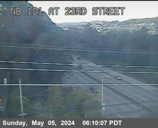
U.S. Highway 101 · San Francisco, CA
San Francisco - US-101 northbound at Faith St POC, San Francisco - View north - MM 432.885 78 ft

U.S. Highway 101 · San Francisco, CA
San Francisco - US-101 southbound at 3rd Bayshore, San Francisco - View south 144 ft
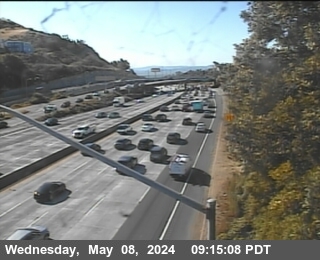
U.S. Highway 101 · San Francisco, CA
San Francisco - US-101 northbound just north of Candlestick Park, San Francisco - View north - MM 428.45 39 ft
U.S. Highway 101 · Brisbane, CA
Brisbane - US-101 northbound at Candlestick off-ramp, Brisbane - View north - MM 429.926 6 ft

U.S. Highway 101 · San Bruno, CA
San Bruno - US-101 southbound at San Bruno Avenue, San Bruno - View south - MM 422.57 6 ft
U.S. Highway 101 · San Bruno, CA
San Bruno - US-101 southbound just north of SFO IC, San Bruno - View south 3 ft

U.S. Highway 101 · Millbrae, CA
Millbrae - US-101 southbound just south of Milbrae Ave overcrossing, Millbrae - View south 3 ft
U.S. Highway 101 · Burlingame, CA
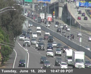
Burlingame - US-101 southbound just north of Broadway, Burlingame - View south - MM 421.429 6 ft

U.S. Highway 101 · Burlingame, CA
Burlingame - US-101 northbound at N101 at Broadway, Burlingame - View north - MM 418.79 13 ft

U.S. Highway 101 · Burlingame, CA
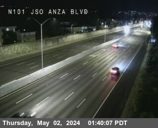
Burlingame - US-101 northbound at N101 just south of Anza Blvd, Burlingame - View north - MM 417.9 13 ft
U.S. Highway 101 · San Mateo, CA
San Mateo - US-101 northbound at 3rd St, San Mateo - View north - MM 417.624 9 ft

U.S. Highway 101 · San Mateo, CA
San Mateo - US-101 northbound at Hillsdale Avenue, San Mateo - View north - MM 413.35 6 ft

U.S. Highway 101 · San Mateo, CA
San Mateo - US-101 northbound just south of East Hillsdale Blvd, San Mateo - View north - MM 412.38

U.S. Highway 101 · Belmont, CA
Belmont - US-101 southbound just south of Ralston Ave, Belmont - View south - MM 413.732

U.S. Highway 101 · San Carlos, CA
San Carlos - US-101 southbound at Holy St, San Carlos - View south - MM 410.65

U.S. Highway 101 · Redwood City, CA
Redwood City - US-101 southbound north of SR-84 / Woodside Road, Redwood City - View south - MM 408.07

U.S. Highway 101 · Redwood City, CA
Redwood City - US-101 southbound at S101 just south of Junction-84, Redwood City - View south - MM 406.82 3 ft
U.S. Highway 101 · Menlo Park, CA
Menlo Park - US-101 northbound north of Willow Road, Menlo Park - View north - MM 404.8 13 ft

U.S. Highway 101 · East Palo Alto, CA
East Palo Alto - US-101 northbound at N101 at Willow Rd, East Palo Alto - View north - MM 404.05 29 ft

U.S. Highway 101 · East Palo Alto, CA
East Palo Alto - US-101 southbound just north of Embarcadero Rd, East Palo Alto - View south - MM 404.213 16 ft

U.S. Highway 101 · Palo Alto, CA
Palo Alto - US-101 northbound at Embarcadero Rd, Palo Alto - View north - MM 403.778 6 ft

U.S. Highway 101 · Mountain View, CA
Mountain View - US-101 northbound at N101 NOF Rengstorff Ave, Mountain View - View north - MM 399.33 6 ft

U.S. Highway 101 · Mountain View, CA
Mountain View - US-101 southbound at Rengstorf Ave, Mountain View - View south - MM 401.239 6 ft

U.S. Highway 101 · Mountain View, CA
Mountain View - US-101 southbound at Old Middlefield Way on-ramp, Mountain View - View south - MM 398.58 22 ft

U.S. Highway 101 · Mountain View, CA
Mountain View - US-101 southbound at N Shoreline Blvd, Mountain View - View south - MM 400.293 26 ft

U.S. Highway 101 · Mountain View, CA
Mountain View - US-101 southbound at Moffett Blvd, Mountain View - View south - MM 397.54 39 ft

U.S. Highway 101 · Mountain View, CA
Mountain View - US-101 southbound at Ellis St SB off-ramp, Mountain View - View south - MM 398.684 39 ft

U.S. Highway 101 · Sunnyvale, CA
Sunnyvale - US-101 northbound just south of Mathilda Ave, Sunnyvale - View north - MM 397.241 29 ft

U.S. Highway 101 · Sunnyvale, CA
Sunnyvale - US-101 southbound at Mathilda Ave, Sunnyvale - View south 29 ft

U.S. Highway 101 · Sunnyvale, CA
Sunnyvale - US-101 northbound at Fair Oaks Ave, Sunnyvale - View north - MM 396.444 26 ft

U.S. Highway 101 · Sunnyvale, CA
Sunnyvale - US-101 northbound at Lawrence Expressway, Sunnyvale - View north - MM 395.467 26 ft

U.S. Highway 101 · San Jose, CA
San Jose - US-101 southbound at DE LA Cruz Blvd, San Jose - View south - MM 392.364 45 ft

U.S. Highway 101 · San Jose, CA
San Jose - US-101 southbound at S101 at Old Oakland Road, San Jose - View south - MM 387.35 55 ft

U.S. Highway 101 · San Jose, CA
San Jose - US-101 northbound at Mckee Rd, San Jose - View north - MM 387.773 82 ft

U.S. Highway 101 · San Jose, CA
San Jose - US-101 northbound at Alum Rock Avenue, San Jose - View north - MM 385.39 88 ft

U.S. Highway 101 · San Jose, CA
San Jose - US-101 northbound at Story Rd, San Jose - View north - MM 386.148 104 ft

U.S. Highway 101 · San Jose, CA
San Jose - US-101 southbound at SOF Tully Rd overcrossing, San Jose - View south - MM 384.67 154 ft

U.S. Highway 101 · San Jose, CA
San Jose - US-101 northbound at Capitol Expressway, San Jose - View north - MM 381.33 137 ft

U.S. Highway 101 · San Jose, CA
San Jose - US-101 northbound at Yerba Buena Rd, San Jose - View north - MM 382.646 183 ft

U.S. Highway 101 · San Jose, CA
San Jose - US-101 southbound at S101 at Hellyer Ave, San Jose - View south - MM 379.74 167 ft

U.S. Highway 101 · San Jose, CA
San Jose - US-101 southbound at Coyote Rd, San Jose - View south - MM 381.244 206 ft

U.S. Highway 101 · San Jose, CA
San Jose - US-101 northbound at Bernal Road, San Jose - View north - MM 376.26 216 ft

U.S. Highway 101 · San Jose, CA
San Jose - US-101 northbound north of Bailey Avenue, San Jose - View north - MM 373.43 298 ft

U.S. Highway 101 · San Jose, CA
San Jose - US-101 southbound at S101 at Bailey Ave, San Jose - View south - MM 372.66 272 ft

U.S. Highway 101 · San Jose, CA
San Jose - US-101 northbound at Coyote Creek Golf Dr, San Jose - View north - MM 372.49 360 ft

U.S. Highway 101 · San Jose, CA
San Jose - US-101 northbound south of Coyote Creek Golf Drive, San Jose - View north - MM 369.52 390 ft

U.S. Highway 101 · San Jose, CA
San Jose - US-101 southbound at Coyote Creek Bridge, San Jose - View south - MM 368.45 360 ft

U.S. Highway 101 · San Jose, CA
San Jose - US-101 southbound south of Burnett Avenue, San Jose - View south - MM 367.84 374 ft

U.S. Highway 101 · Morgan Hill, CA
Morgan Hill - US-101 northbound at Cochrane Rd IC, Morgan Hill - View north 360 ft

U.S. Highway 101 · Morgan Hill, CA
Morgan Hill - US-101 northbound south of East Main Avenue, Morgan Hill - View north - MM 365.89 360 ft

U.S. Highway 101 · Morgan Hill, CA
Morgan Hill - US-101 northbound at East Dunne Avenue, Morgan Hill - View north - MM 365.26 364 ft

U.S. Highway 101 · San Martin, CA
San Martin - US-101 northbound south of Tenant Avenue, San Martin - View north - MM 363.62 314 ft

U.S. Highway 101 · San Martin, CA
San Martin - US-101 northbound south of East Middle Avenue, San Martin - View north - MM 362.66 295 ft

U.S. Highway 101 · San Martin, CA
San Martin - US-101 northbound at San Martin Avenue, San Martin - View north - MM 361.72 288 ft

U.S. Highway 101 · San Martin, CA
San Martin - US-101 northbound at Weigh Station, San Martin - View north - MM 360.64 262 ft

U.S. Highway 101 · San Martin, CA
San Martin - US-101 northbound at Masten Blvd, San Martin - View north - MM 359.55 242 ft

U.S. Highway 101 · Gilroy, CA
Gilroy - US-101 southbound at SAN Martin Weight Station, Gilroy - View south - MM 358.14 219 ft

U.S. Highway 101 · Gilroy, CA
Gilroy - US-101 southbound at Leavesley Road, Gilroy - View south - MM 356.84 200 ft

U.S. Highway 101 · Gilroy, CA
Gilroy - US-101 southbound south of Monterey Road, Gilroy - View south - MM 354.14 190 ft

U.S. Highway 101 · Gilroy, CA
Gilroy - US-101 northbound at Carnadero Creek, Gilroy - View north - MM 353.48 187 ft

U.S. Highway 101 · Gilroy, CA
Gilroy - US-101 northbound south of SR-25, Gilroy - View north - MM 351.32 137 ft

U.S. Highway 101 · Gilroy, CA
Gilroy - US-101 southbound north of Sargent Bridge, Gilroy - View south - MM 350.23 177 ft

U.S. Highway 101
US-101 southbound at Before Pajarro River BR, Santa Clara County - View south - MM 349.41 137 ft

I-80 · Vacaville, CA
Vacaville - I-80 westbound at Leisure Town Rd, Vacaville - View west - MM 57.327 88 ft

I-80 · Vacaville, CA
Vacaville - I-80 eastbound at WOF Leisure Town Rd, Vacaville - View east - MM 56.782 88 ft

I-80 · Vacaville, CA
Vacaville - I-80 eastbound at RTE505 Junction, Vacaville - View east 104 ft

I-80 · Vacaville, CA
Vacaville - I-80 eastbound at Bella Vista Rd, Vacaville - View east 170 ft

I-80 · Vacaville, CA
Vacaville - I-80 westbound at Alamo Dr, Vacaville - View west 177 ft

I-80 · Vacaville, CA
Vacaville - I-80 westbound at Cherry Glen Rd OR, Vacaville - View west 219 ft

I-80 · Vacaville, CA
Vacaville - I-80 eastbound at Lagoon Valley Rd, Vacaville - View east 252 ft

I-80 · Fairfield, CA
Fairfield - I-80 westbound at WOF Manuel Campos Pkwy, Fairfield - View west - MM 47.734 111 ft

I-80 · Fairfield, CA
Fairfield - I-80 westbound at Lincoln Hwy IC, Fairfield - View west 42 ft

I-80 · Fairfield, CA
Fairfield - I-80 eastbound at Chadbourne Rd, Fairfield - View east 36 ft

I-80 · Fairfield, CA
Fairfield - I-80 eastbound just west of Junction 12, Fairfield - View east 29 ft

I-80 · Fairfield, CA
Fairfield - I-80 eastbound at After TRE 12 IC, Fairfield - View east 42 ft

I-80 · Fairfield, CA
Fairfield - I-80 westbound west of Green Valley Road, Fairfield - View west - MM 39.64 49 ft

I-80 · Fairfield, CA
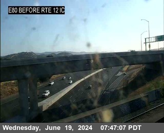
Fairfield - I-80 eastbound at Before TRE 12 IC, Fairfield - View east 65 ft
I-80 · Fairfield, CA
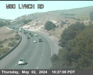
Fairfield - I-80 westbound at Lynch Rd, Fairfield - View west 311 ft
I-80 · Vallejo, CA
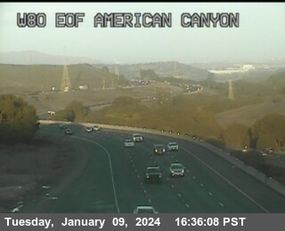
Vallejo - I-80 westbound at EOF American Canyon Rd, Vallejo - View west 380 ft
I-80 · Vallejo, CA
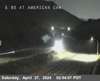
Vallejo - I-80 eastbound at E80 at American Canyon Rd overcrossing, Vallejo - View east - MM 35.66 423 ft
I-80 · Vallejo, CA
Vallejo - I-80 westbound east of SR-37, Vallejo - View west - MM 34.13 449 ft
I-80 · Vallejo, CA
Vallejo - I-80 westbound just west of Redwood Pkwy, Vallejo - View west 95 ft

I-80 · Vallejo, CA
Vallejo - I-80 westbound at North Tower, Vallejo - View west - MM 27.72
I-80 · Crockett, CA
Crockett - I-80 westbound at South Tower, Crockett - View west - MM 27.28 3 ft
I-80 · Crockett, CA
Crockett - I-80 westbound just west of Carquinez Brdg, Crockett - View west - MM 26.63 213 ft
I-80 · Crockett, CA
Crockett - I-80 eastbound just east of Cummings Pkwy, Crockett - View east - MM 26.48 259 ft

I-80 · Rodeo, CA
Rodeo - I-80 westbound at Cummings Parkway on-ramp, Rodeo - View west - MM 26.06 242 ft
I-80 · Rodeo, CA
Rodeo - I-80 westbound just west of Cummings Skwy, Rodeo - View west - MM 25.3 164 ft
I-80 · Rodeo, CA
Rodeo - I-80 westbound just east of Willow Avenue, Rodeo - View west - MM 24.7 157 ft
I-80 · Rodeo, CA
Rodeo - I-80 westbound at Willow Avenue on-ramp, Rodeo - View west - MM 24.07 45 ft
I-80 · Rodeo, CA
Rodeo - I-80 eastbound at Willow Avenue, Rodeo - View east - MM 24.05 36 ft
I-80 · Hercules, CA
Hercules - I-80 eastbound at SR-4, Hercules - View east - MM 23.52 78 ft
I-80 · Hercules, CA
Hercules - I-80 westbound at Before Sycamore Avenue, Hercules - View west - MM 23.25 59 ft
I-80 · Pinole, CA
Pinole - I-80 westbound at Before Pinole Valley Road, Pinole - View west - MM 22.29 157 ft
I-80 · Pinole, CA
Pinole - I-80 westbound at Pinole Valley Road, Pinole - View west - MM 21.86 39 ft
I-80 · Pinole, CA
Pinole - I-80 eastbound at Pinole Valley Road, Pinole - View east - MM 21.85 52 ft
I-80 · Pinole, CA
Pinole - I-80 westbound just east of Appian Way, Pinole - View west - MM 21 190 ft
I-80 · Pinole, CA
Pinole - I-80 eastbound east of Richmond Parkway, Pinole - View east - MM 20.55 206 ft
I-80 · Tara Hills, CA
Tara Hills - I-80 westbound at Richmond Parkway, Tara Hills - View west - MM 20.05 242 ft
I-80 · Pinole, CA
Pinole - I-80 eastbound at Richmond Parkway, Pinole - View east - MM 20.11 269 ft
I-80 · Richmond, CA
Richmond - I-80 eastbound just east of Hilltop Drive, Richmond - View east - MM 19.74 229 ft
I-80 · Richmond, CA
Richmond - I-80 eastbound at E80 at Hilltop Dr, Richmond - View east - MM 19.36 291 ft
I-80 · Richmond, CA
Richmond - I-80 westbound at Hilltop Drive, Richmond - View west - MM 19.34 291 ft
I-80 · San Pablo, CA
San Pablo - I-80 eastbound just east of El Portal Drive, San Pablo - View east - MM 18.42 82 ft
I-80 · San Pablo, CA
San Pablo - I-80 westbound at San Pablo Dam Road, San Pablo - View west - MM 17.91 141 ft
I-80 · San Pablo, CA
San Pablo - I-80 westbound at San Pablo Dam Road Offramp, San Pablo - View west - MM 17.69 124 ft
I-80 · San Pablo, CA
San Pablo - I-80 westbound at San Pablo Dam Road Offramp, San Pablo - View west - MM 17.69 124 ft
I-80 · El Cerrito, CA
El Cerrito - I-80 eastbound at Cutting Blvd OR, El Cerrito - View east - MM 7.36 55 ft
I-80 · El Cerrito, CA
El Cerrito - I-80 eastbound just west of Cutting Blvd, El Cerrito - View east 52 ft
I-80 · El Cerrito, CA
El Cerrito - I-80 eastbound at E80 at Potrero Ave, El Cerrito - View east - MM 15.04 42 ft
I-80 · Richmond, CA
Richmond - I-80 eastbound at Central Avenue on-ramp, Richmond - View east - MM 13.58 26 ft
I-80 · Richmond, CA
Richmond - I-80 eastbound at Central Avenue on-ramp, Richmond - View east - MM 13.58 26 ft
I-80 · Richmond, CA
Richmond - I-80 eastbound at Central Avenue on-ramp, Richmond - View east - MM 13.56 26 ft
I-80 · Albany, CA
Albany - I-80 westbound at WOF Albany OR, Albany - View west - MM 13.05 22 ft
I-80 · Albany, CA
Albany - I-80 eastbound at Buchanan Street, Albany - View east - MM 63.17 19 ft
I-80 · Berkeley, CA
Berkeley - I-80 eastbound at Gilman Street Offramp, Berkeley - View east - MM 11.96 16 ft

I-80 · Berkeley, CA
Berkeley - I-80 westbound at Gilman Street, Berkeley - View west - MM 11.96 6 ft

I-80 · Berkeley, CA
Berkeley - I-80 westbound at Ashby, Berkeley - View west - MM 10.13
I-80 · San Francisco, CA
San Francisco - I-80 eastbound at US-101, San Francisco - View east - MM 0.3 13 ft
California State Route 121 · Napa, CA
Napa - CA-121 southbound at SR-29 / SR-12, Napa - View south - MM 16.05 9 ft

California State Route 12 · American Canyon, CA
American Canyon - CA-12 westbound at EOF Kelly Rd, American Canyon - View west 150 ft

California State Route 12 · Napa, CA
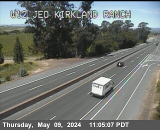
Napa - CA-12 westbound at Kirkland Ranch Road, Napa - View west - MM 34.97 239 ft
California State Route 12 · Napa, CA
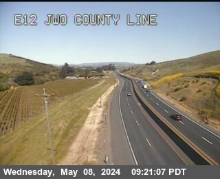
Napa - CA-12 eastbound at E12 Before County Line, Napa - View east - MM 35.78 288 ft
California State Route 12 · Fairfield, CA
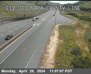
Fairfield - CA-12 eastbound east of Napa County Line, Fairfield - View east - MM 36.71 291 ft
California State Route 12 · Fairfield, CA
Fairfield - CA-12 eastbound at E12 EOF Miners Trail, Fairfield - View east - MM 37.54 249 ft
I-680 · Fairfield, CA
Fairfield - I-680 southbound just south of I-80, Fairfield - View south - MM 69.7 42 ft

I-680 · Fairfield, CA
Fairfield - I-680 northbound just south of Marshview Road, Fairfield - View north - MM 65.13 9 ft
I-680 · Benicia, CA
Benicia - I-680 southbound at Bayshore Rd, Benicia - View south 36 ft
I-680 · Benicia, CA
Benicia - I-680 northbound south of I-780, Benicia - View north - MM 57.59
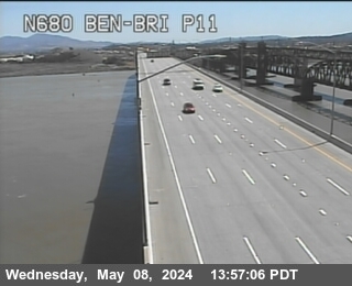
I-680 · Martinez, CA
Martinez - I-680 southbound at S680 at Marina Vista, Martinez - View south - MM 55.97 6 ft

I-680 · Vine Hill, CA
Vine Hill - I-680 northbound at Sewage Plant Rd, Vine Hill - View north - MM 55.13 19 ft
I-680 · Pleasant Hill, CA
Pleasant Hill - I-680 southbound at Contra Costa Blvd, Pleasant Hill - View south - MM 52.151 36 ft

I-680 · Concord, CA
Concord - I-680 southbound at Willow Pass Rd on-s-diag, Concord - View south - MM 51.276 39 ft

I-680 · Concord, CA
Concord - I-680 northbound at Junction 242, Concord - View north - MM 0.305 52 ft

I-680 · Concord, CA
Concord - I-680 northbound at Sourth of SR-242, Concord - View north - MM 50.07 45 ft

I-680 · Pleasant Hill, CA
Pleasant Hill - I-680 southbound north of Monument Blvd, Pleasant Hill - View south - MM 49.61 62 ft

I-680 · Pleasant Hill, CA
Pleasant Hill - I-680 northbound at Monument Blvd, Pleasant Hill - View north 52 ft

I-680 · Pleasant Hill, CA
Pleasant Hill - I-680 southbound just south of Monument Blvd, Pleasant Hill - View south 45 ft

I-680 · Pleasant Hill, CA
Pleasant Hill - I-680 northbound at Oak Park Blvd, Pleasant Hill - View north - MM 48.37 72 ft

I-680 · Contra Costa Centre, CA
Contra Costa Centre - I-680 northbound at Treat Blvd, Contra Costa Centre - View north 95 ft

I-680 · Walnut Creek, CA
Walnut Creek - I-680 southbound at North Main Street, Walnut Creek - View south - MM 47.02 121 ft

I-680 · Walnut Creek, CA
Walnut Creek - I-680 southbound at MT Diablo, Walnut Creek - View south 196 ft

I-680 · Walnut Creek, CA
Walnut Creek - I-680 northbound just south of Oakvale Rd overcrossing, Walnut Creek - View north - MM 45.956 206 ft

I-680 · Walnut Creek, CA
Walnut Creek - I-680 northbound at MT Diablo Blvd, Walnut Creek - View north - MM 45.692 196 ft

I-680 · Walnut Creek, CA
Walnut Creek - I-680 northbound just north of Olympic Blvd, Walnut Creek - View north - MM 45.594 187 ft

I-680 · Walnut Creek, CA
Walnut Creek - I-680 northbound at Olympic Blvd off-ramp, Walnut Creek - View north - MM 45.3 167 ft

I-680 · Walnut Creek, CA
Walnut Creek - I-680 southbound at S Main Avenue, Walnut Creek - View south - MM 44.63 177 ft

I-680 · Alamo, CA
Alamo - I-680 southbound just north of Livorna Road, Alamo - View south - MM 43.03 249 ft

I-680 · Danville, CA
Danville - I-680 northbound just south of Diablo Road, Danville - View north - MM 38.86 374 ft
I-680 · Danville, CA
Danville - I-680 southbound just south of Greenbrook Drive Overcross, Danville - View south - MM 36.49 462 ft

I-680 · San Ramon, CA
San Ramon - I-680 southbound just north of Montevideo Road, San Ramon - View south - MM 33.34 436 ft

I-680 · San Ramon, CA
San Ramon - I-680 northbound just south of Alcosta Blvd, San Ramon - View north - MM 31.43 387 ft

I-680 · Pleasanton, CA
Pleasanton - I-680 southbound at Stoneridge Drive, Pleasanton - View south - MM 28.84 324 ft
I-680 · Sunol, CA
Sunol - I-680 northbound at Koopman Rd undercrossing, Sunol - View north - MM 22.02 282 ft
I-680 · Sunol, CA
Sunol - I-680 southbound at Calaveras Rd, Sunol - View south 239 ft

I-680 · Fremont, CA
Fremont - I-680 southbound at Mission 238 Blvd, Fremont - View south 124 ft

I-680 · Fremont, CA
Fremont - I-680 southbound at Mission Blvd - 262, Fremont - View south - MM 12.35 124 ft

I-680 · Fremont, CA
Fremont - I-680 northbound at Scott Creek Rd, Fremont - View north 108 ft

I-680 · Milpitas, CA
Milpitas - I-680 northbound at Jacklin Road, Milpitas - View north 26 ft

I-680 · Milpitas, CA
Milpitas - I-680 southbound at S680 at 237, Milpitas - View south 62 ft

I-680 · Milpitas, CA
Milpitas - I-680 northbound just north of Landess Avenue, Milpitas - View north 52 ft

I-680 · San Jose, CA
San Jose - I-680 northbound just south of Landess Ave, San Jose - View north 68 ft

I-680 · San Jose, CA
San Jose - I-680 northbound just north of Berryessa Avenue, San Jose - View north 137 ft

I-680 · San Jose, CA
San Jose - I-680 northbound just north of Mckee Road, San Jose - View north 118 ft

I-680 · San Jose, CA
San Jose - I-680 southbound at Jackson Avenue, San Jose - View south 98 ft

I-680 · San Jose, CA
San Jose - I-680 southbound at King Road, San Jose - View south 95 ft

California State Route 37
CA-37 westbound east of SR-121, Sonoma County - View west - MM 8.82

California State Route 37
CA-37 westbound at SR-121, Sonoma County - View west - MM 6.91 118 ft

California State Route 37 · Vallejo, CA
Vallejo - CA-37 westbound at Junction-29, Vallejo - View west 22 ft
California State Route 37 · Vallejo, CA
Vallejo - CA-37 westbound at W37 EOF Junction-29, Vallejo - View west - MM 20.06 111 ft
California State Route 37 · Black Point-Green Point, CA
Black Point-Green Point - CA-37 eastbound at Lakeville Road, Black Point-Green Point - View east - MM 5.5
California State Route 37 · Vallejo, CA
Vallejo - CA-37 westbound at Wilson Ave, Vallejo - View west - MM 17.82 29 ft
California State Route 37 · Black Point-Green Point, CA
Black Point-Green Point - CA-37 eastbound at E37 at Atherton Ave, Black Point-Green Point - View east - MM 2.55 42 ft

California State Route 37 · Novato, CA
Novato - CA-37 northbound at N101 at Junction 37, Novato - View north - MM 0.02 6 ft

I-780 · Vallejo, CA
Vallejo - I-780 eastbound at Junction 780, Vallejo - View east - MM 6.674 29 ft

I-780 · Benicia, CA
Benicia - I-780 eastbound at I-680 Split, Benicia - View east - MM 0.52 164 ft
California State Route 4 · Bay Point, CA
Bay Point - CA-4 westbound at WOF SAN Marco Blvd/Willow Pass Rd, Bay Point - View west 305 ft

California State Route 4 · Bay Point, CA
Bay Point - CA-4 westbound at San Marco Blvd, Bay Point - View west - MM 18.48 200 ft

California State Route 4 · Pittsburg, CA
Pittsburg - CA-4 eastbound at EOF SAN Marco Blvd, Pittsburg - View east 144 ft

California State Route 4 · Pittsburg, CA
Pittsburg - CA-4 eastbound east of Bailey Road, Pittsburg - View east - MM 21.22 68 ft

California State Route 4 · Pittsburg, CA
Pittsburg - CA-4 westbound just west of Railroad Avenue, Pittsburg - View west - MM 22.31 45 ft

California State Route 4 · Hercules, CA
Hercules - CA-4 eastbound at E80 at EB80 to EB 4 County Road, Hercules - View east - MM 0.24 59 ft
California State Route 4 · Bay Point, CA
Bay Point - CA-4 eastbound just east of Willow Pass Road, Bay Point - View east - MM 16.75 252 ft

California State Route 4 · Pittsburg, CA
Pittsburg - CA-4 westbound at Loveridge Road, Pittsburg - View west - MM 24.1 39 ft

California State Route 4 · Pittsburg, CA
Pittsburg - CA-4 eastbound at Loveridge Road, Pittsburg - View east - MM 24.16 45 ft

California State Route 4 · Pittsburg, CA
Pittsburg - CA-4 eastbound at EOF Loveridge Rd, Pittsburg - View east 42 ft

California State Route 4 · Concord, CA
Concord - CA-4 eastbound at Port Chicago Hwy, Concord - View east - MM 15.28 85 ft

California State Route 4 · Antioch, CA
Antioch - CA-4 eastbound at Century Blvd, Antioch - View east - MM 24.8 68 ft

California State Route 4 · Antioch, CA
Antioch - CA-4 westbound at Somerville Road, Antioch - View west - MM 25.73 78 ft

California State Route 4 · Antioch, CA
Antioch - CA-4 westbound at Contra Loma Blvd / L Street, Antioch - View west - MM 26.69 36 ft

California State Route 4 · Antioch, CA
Antioch - CA-4 westbound just west of Hillcrest Avenue, Antioch - View west - MM 28.11 52 ft

California State Route 4 · Antioch, CA
Antioch - CA-4 westbound at Hillcrest Avenue, Antioch - View west - MM 28.68 59 ft

California State Route 4 · Martinez, CA
Martinez - CA-4 westbound at Morello Ave, Martinez - View west - MM 10.23 183 ft

California State Route 4 · Martinez, CA
Martinez - CA-4 westbound at Pine St, Martinez - View west 219 ft

California State Route 4 · Pacheco, CA
Pacheco - CA-4 northbound at I-680, Pacheco - View north - MM 12.48 16 ft

California State Route 4 · Martinez, CA
Martinez - CA-4 eastbound at E4 at Morello Ave, Martinez - View east - MM 10.73 150 ft

California State Route 4 · Martinez, CA
Martinez - CA-4 eastbound at Alhambra Ave, Martinez - View east 121 ft

California State Route 4 · Antioch, CA
Antioch - CA-4 eastbound at Laurel Road, Antioch - View east - MM 31.16 121 ft

California State Route 4 · Antioch, CA
Antioch - CA-4 westbound at Lone Tree Way, Antioch - View west - MM 32.71 118 ft

California State Route 4 · Brentwood, CA
Brentwood - CA-4 westbound at EOF Lone Tree WAY, Brentwood - View west 131 ft

California State Route 4 · Brentwood, CA
Brentwood - CA-4 eastbound at Sand Creek Road, Brentwood - View east - MM 34.02 134 ft

California State Route 160 · Antioch, CA
Antioch - CA-160 northbound at Oakley Road, Antioch - View north 72 ft

California State Route 242 · Concord, CA
Concord - CA-242 southbound at Olivera Rd, Concord - View south 59 ft

California State Route 242 · Concord, CA
Concord - CA-242 northbound at Grant St Solano WY OR, Concord - View north - MM 2.51 65 ft

California State Route 242 · Concord, CA
Concord - CA-242 northbound at Concord Ave, Concord - View north - MM 1.71 49 ft

California State Route 242 · Concord, CA
Concord - CA-242 southbound at Clayton Road, Concord - View south - MM 1.04 29 ft

I-580 · San Rafael, CA
San Rafael - I-580 westbound at WOF Francisco Blvd, San Rafael - View west - MM 75.738 6 ft

I-580 · San Rafael, CA
San Rafael - I-580 eastbound at Wof Main St, San Rafael - View east - MM 74.84 52 ft
I-580 · San Rafael, CA
San Rafael - I-580 eastbound at Lower Deck Pier 8, San Rafael - View east - MM 73.43

I-580 · San Rafael, CA
San Rafael - I-580 eastbound at Lower Deck Pier 23, San Rafael - View east - MM 73
I-580 · Richmond, CA
Richmond - I-580 eastbound at Lower Deck Pier 33, Richmond - View east - MM 72.45
I-580 · Richmond, CA
Richmond - I-580 eastbound at Lower Deck Pier 34, Richmond - View east - MM 72.34
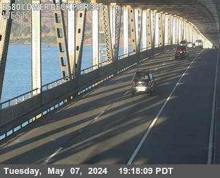
I-580 · Richmond, CA
Richmond - I-580 eastbound at Lower Deck Pier 41, Richmond - View east - MM 71.76
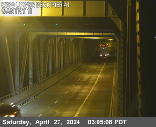
I-580 · Richmond, CA
Richmond - I-580 eastbound at Lower Deck Pier 43, Richmond - View east - MM 71.65
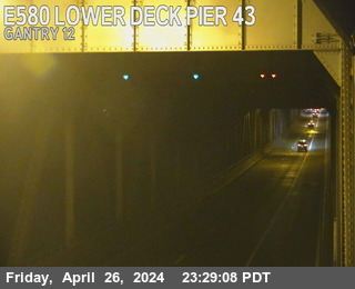
I-580 · Richmond, CA
Richmond - I-580 eastbound at Lower Deck Pier 46, Richmond - View east - MM 71.49
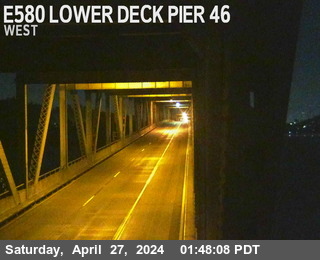
I-580 · Richmond, CA
Richmond - I-580 westbound at Upper Deck Pier 48, Richmond - View west - MM 71.18
I-580 · Richmond, CA
Richmond - I-580 westbound at Upper Deck Truss Tower Pier 48, Richmond - View west - MM 71.18
I-580 · Richmond, CA
Richmond - I-580 eastbound at Lower Deck Pier 54, Richmond - View east - MM 70.8
I-580 · Richmond, CA
Richmond - I-580 eastbound at Lower Deck Pier 57, Richmond - View east - MM 70.64
I-580 · Richmond, CA
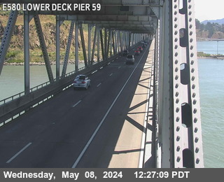
Richmond - I-580 eastbound at Lower Deck Pier 59, Richmond - View east - MM 70.53
I-580 · Richmond, CA
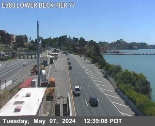
Richmond - I-580 eastbound at Lower Deck Pier 77, Richmond - View east - MM 70.1
I-580 · Richmond, CA
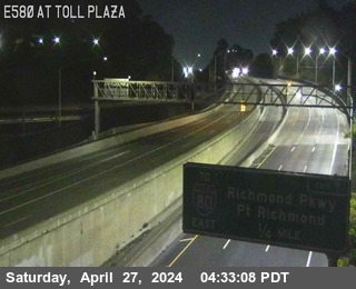
Richmond - I-580 eastbound at Toll Plaza, Richmond - View east - MM 69.87 29 ft
I-580 · Richmond, CA
Richmond - I-580 westbound at Cutting Blvd, Richmond - View west - MM 67.636

I-580 · Richmond, CA
Richmond - I-580 westbound at Cutting Blvd, Richmond - View west - MM 67.61
I-580 · Oakland, CA
Oakland - I-580 eastbound at Peralta St, Oakland - View east 36 ft
I-580 · Oakland, CA
Oakland - I-580 eastbound just east of 80 Junction, Oakland - View east - MM 62.776


I-580 · Oakland, CA
Oakland - I-580 westbound at Chetwood St, Oakland - View west 108 ft
I-580 · Oakland, CA
Oakland - I-580 eastbound at Grand Lakeshore, Oakland - View east - MM 59.81 36 ft
I-580 · Oakland, CA
Oakland - I-580 eastbound just east of Lakeshore Ave, Oakland - View east 72 ft

I-580 · Oakland, CA
Oakland - I-580 westbound at 35th Avenue, Oakland - View west - MM 57.05 180 ft
I-580 · Oakland, CA
Oakland - I-580 eastbound at High Street, Oakland - View east - MM 56.34 167 ft
I-580 · Oakland, CA
Oakland - I-580 eastbound just west of Macarthur Blvd, Oakland - View east 177 ft

I-580 · Oakland, CA
Oakland - I-580 westbound at Junction 13, Oakland - View west 246 ft
I-580 · Oakland, CA
Oakland - I-580 westbound just west of Edwards Ave, Oakland - View west 314 ft

I-580 · Oakland, CA
Oakland - I-580 westbound at Keller Ave overcrossing, Oakland - View west 311 ft

I-580 · Oakland, CA
Oakland - I-580 westbound just east of Fontaine St, Oakland - View west 285 ft

I-580 · Oakland, CA
Oakland - I-580 eastbound at Golf Links Rd, Oakland - View east 173 ft

I-580 · Oakland, CA
Oakland - I-580 eastbound just west of 106th Ave overcrossing, Oakland - View east - MM 52.239 173 ft

I-580 · Oakland, CA
Oakland - I-580 westbound just west of Foothill Blvd, Oakland - View west 78 ft
I-580 · Mountain House, CA
Mountain House - I-580 westbound just east of I-205, Mountain House - View west - MM 15.96 275 ft
I-580 · Livermore, CA
Livermore - I-580 northbound west of Flynn Road, Livermore - View north - MM 22.71 961 ft

I-580 · San Leandro, CA
San Leandro - I-580 eastbound just east of Grand Avenue, San Leandro - View east - MM 49.557 78 ft
I-580 · Livermore, CA
Livermore - I-580 westbound at Greenville Rd, Livermore - View west 580 ft

I-580 · Livermore, CA
Livermore - I-580 westbound at Vasco Rd, Livermore - View west 538 ft

I-580 · Ashland, CA
Ashland - I-580 eastbound just east of Fairmont Dr overcrossing, Ashland - View east - MM 48.603 49 ft

I-580 · Livermore, CA
Livermore - I-580 westbound at First Street, Livermore - View west - MM 26.89 531 ft

I-580 · Castro Valley, CA
Castro Valley - I-580 westbound at Foothill Blvd, Castro Valley - View west - MM 48.013 108 ft

I-580 · Pleasanton, CA
Pleasanton - I-580 westbound at Tassajara, Pleasanton - View west - MM 34.11 341 ft

I-580 · Dublin, CA
Dublin - I-580 westbound at Fallon Rd Loop, Dublin - View west 351 ft

I-580 · Pleasanton, CA
Pleasanton - I-580 westbound at Hacienda Rd, Pleasanton - View west - MM 34.48 344 ft
I-580 · Pleasanton, CA
Pleasanton - I-580 westbound at I-680, Pleasanton - View west - MM 36.86 328 ft

I-580 · Livermore, CA
Livermore - I-580 westbound at Airway Blvd, Livermore - View west 416 ft

I-580 · Pleasanton, CA
Pleasanton - I-580 eastbound at Hopyard Loop on-ramp, Pleasanton - View east - MM 36.04 331 ft

I-580 · Pleasanton, CA
Pleasanton - I-580 eastbound at Hacienda Dr OR, Pleasanton - View east - MM 34.99 341 ft
I-580 · Castro Valley, CA
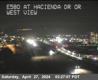
Castro Valley - I-580 westbound just east of Castro Valley Blvd, Castro Valley - View west - MM 43.182 387 ft

I-580 · Pleasanton, CA
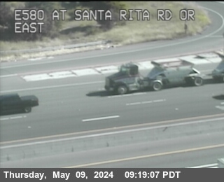
Pleasanton - I-580 eastbound at Santa Rita Rd OR, Pleasanton - View east 351 ft
I-580 · Livermore, CA
Livermore - I-580 eastbound east of El Charro Road, Livermore - View east - MM 32.05 370 ft
I-580 · Pleasanton, CA
Pleasanton - I-580 eastbound at Foothill Blvd, Pleasanton - View east 364 ft

I-580 · Castro Valley, CA
Castro Valley - I-580 westbound at Castro Valley Blvd OR, Castro Valley - View west - MM 44.58 229 ft
I-580 · Fairview, CA
Fairview - I-580 eastbound just east of Grove Way, Fairview - View east - MM 44.2 288 ft
I-580 · Castro Valley, CA
Castro Valley - I-580 westbound at Strobridge Avenue, Castro Valley - View west - MM 46.39 180 ft
I-580 · Castro Valley, CA
Castro Valley - I-580 northbound at SR-238, Castro Valley - View north - MM 46.99 157 ft
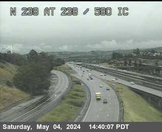
I-580 · Castro Valley, CA
Castro Valley - I-580 eastbound at Redwood Road, Castro Valley - View east - MM 45.58 170 ft
California State Route 123 · El Cerrito, CA
El Cerrito - CA-123 northbound at Cutting Blvd, El Cerrito - View north - MM 7.28 45 ft
California State Route 123 · El Cerrito, CA
El Cerrito - CA-123 northbound at Cutting Blvd, El Cerrito - View north - MM 7.27 45 ft
California State Route 123 · El Cerrito, CA
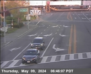
El Cerrito - CA-123 northbound at Cutting Blvd, El Cerrito - View north - MM 7.28 42 ft
California State Route 123 · El Cerrito, CA
El Cerrito - CA-123 northbound at Cutting Blvd, El Cerrito - View north - MM 7.28 42 ft
California State Route 123 · El Cerrito, CA
El Cerrito - CA-123 northbound at Potrero Avenue, El Cerrito - View north - MM 6.93 49 ft
California State Route 123 · El Cerrito, CA
El Cerrito - CA-123 northbound at Potrero Avenue, El Cerrito - View north - MM 6.93 49 ft
California State Route 123 · El Cerrito, CA
El Cerrito - CA-123 northbound at Potrero Avenue, El Cerrito - View north - MM 6.93 49 ft
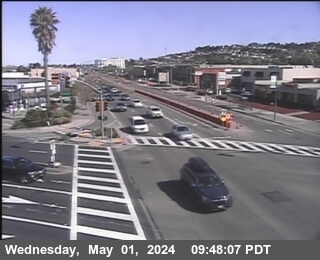
California State Route 123 · El Cerrito, CA
El Cerrito - CA-123 northbound at Potrero Avenue, El Cerrito - View north - MM 6.93 49 ft
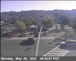
California State Route 123 · El Cerrito, CA
El Cerrito - CA-123 southbound at Central Avenue, El Cerrito - View south - MM 5.48 29 ft
California State Route 123 · El Cerrito, CA
El Cerrito - CA-123 southbound at Central Avenue, El Cerrito - View south - MM 5.48 29 ft
California State Route 123 · El Cerrito, CA
El Cerrito - CA-123 southbound at Central Avenue, El Cerrito - View south - MM 5.48 29 ft
California State Route 123 · El Cerrito, CA
El Cerrito - CA-123 southbound at Central Avenue, El Cerrito - View south - MM 5.46 29 ft
California State Route 123 · Berkeley, CA
Berkeley - CA-123 northbound at Gilman Street, Berkeley - View north 52 ft
California State Route 123 · Berkeley, CA
Berkeley - CA-123 northbound at Gilman Street, Berkeley - View north 52 ft
California State Route 123 · Berkeley, CA
Berkeley - CA-123 northbound at Gilman Street, Berkeley - View north 52 ft
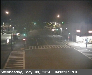
California State Route 123 · Berkeley, CA
Berkeley - CA-123 northbound at Gilman Street, Berkeley - View north 52 ft
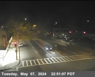
California State Route 123 · Berkeley, CA
Berkeley - CA-123 northbound at University Avenue, Berkeley - View north 59 ft
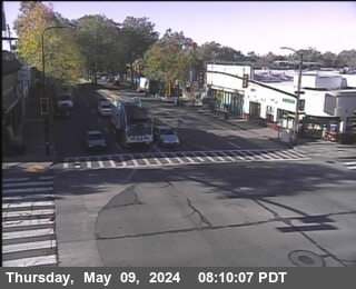
California State Route 123 · Berkeley, CA
Berkeley - CA-123 northbound at University Avenue, Berkeley - View north 52 ft
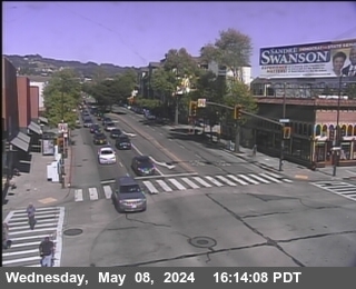
California State Route 123 · Berkeley, CA
Berkeley - CA-123 northbound at University Avenue, Berkeley - View north 59 ft
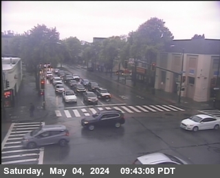
California State Route 123 · Berkeley, CA
Berkeley - CA-123 northbound at University Avenue, Berkeley - View north 52 ft
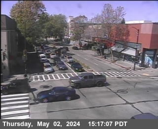
California State Route 123 · Berkeley, CA
Berkeley - CA-123 southbound at Ashby Avenue, Berkeley - View south 49 ft
California State Route 123 · Berkeley, CA
Berkeley - CA-123 southbound at Ashby Avenue, Berkeley - View south 49 ft
California State Route 123 · Berkeley, CA
Berkeley - CA-123 southbound at Ashby Avenue, Berkeley - View south 39 ft
California State Route 123 · Berkeley, CA
Berkeley - CA-123 southbound at Ashby Avenue, Berkeley - View south 39 ft
California State Route 123 · Oakland, CA
Oakland - CA-123 westbound at Stanford Ave, Oakland - View west 36 ft
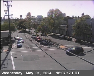
California State Route 123 · Oakland, CA
Oakland - CA-123 southbound at Stanford Ave, Oakland - View south 36 ft
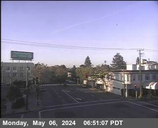
California State Route 123 · Oakland, CA
Oakland - CA-123 northbound at Stanford Ave, Oakland - View north 42 ft
California State Route 123 · Oakland, CA
Oakland - CA-123 eastbound at Stanford Ave, Oakland - View east 36 ft
California State Route 123 · Emeryville, CA
Emeryville - CA-123 northbound at 40th Street, Emeryville - View north 42 ft
California State Route 123 · Emeryville, CA
Emeryville - CA-123 northbound at 40th Street, Emeryville - View north 42 ft
California State Route 123 · Emeryville, CA
Emeryville - CA-123 northbound at 40th Street, Emeryville - View north 42 ft
California State Route 24 · Lafayette, CA
Lafayette - CA-24 westbound at W24 at Pleasant Hill Rd, Lafayette - View west - MM 12.02 308 ft
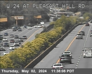
California State Route 24 · Orinda, CA
Orinda - CA-24 westbound at W24 just east of St Stephens Drive overcrossing, Orinda - View west - MM 8.11 646 ft
California State Route 24 · Lafayette, CA
Lafayette - CA-24 eastbound at E24 WOF Dolores Rd, Lafayette - View east - MM 9.75 465 ft

California State Route 24 · Orinda, CA
Orinda - CA-24 westbound at W24 just east of Camino Pablo, Orinda - View west - MM 7.03 574 ft
California State Route 24 · Orinda, CA
Orinda - CA-24 westbound at Camino Pablo, Orinda - View west 521 ft
California State Route 24 · Orinda, CA
Orinda - CA-24 eastbound at Gateway Blvd, Orinda - View east - MM 5.56 721 ft
California State Route 24 · Oakland, CA
Oakland - CA-24 westbound at Caldecott, Oakland - View west 672 ft

California State Route 24 · Oakland, CA
Oakland - CA-24 eastbound at SR-13, Oakland - View east - MM 3.37 524 ft

California State Route 24 · Oakland, CA
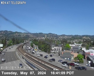
Oakland - CA-24 westbound at Telegraph, Oakland - View west - MM 1.109 121 ft
California State Route 24 · Oakland, CA
Oakland - CA-24 westbound at W24 just east of Junction 980, Oakland - View west - MM 0.33 88 ft
California State Route 13 · Berkeley, CA
Berkeley - CA-13 northbound at E13 AT 7th St, Berkeley - View north - MM 9.23 36 ft
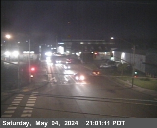
California State Route 13 · Berkeley, CA
Berkeley - CA-13 southbound at E13 AT 7th St, Berkeley - View south - MM 9.25 36 ft
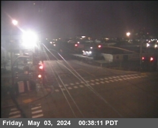
California State Route 13 · Berkeley, CA
Berkeley - CA-13 northbound at E13 AT 7th St, Berkeley - View north - MM 9.22 36 ft
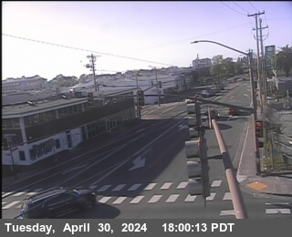
California State Route 13 · Berkeley, CA
Berkeley - CA-13 northbound at E13 AT 7th St, Berkeley - View north - MM 9.25 36 ft
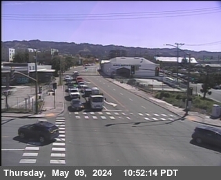
I-880 · Emeryville, CA
Emeryville - I-880 eastbound at County Road WOF Powell St, Emeryville - View east - MM 45.76 9 ft
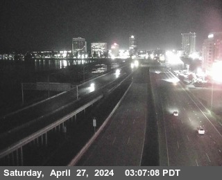
I-880 · Oakland, CA
Oakland - I-880 northbound at Junction 80, Oakland - View north - MM 44.663

I-880 · Oakland, CA
Oakland - I-880 northbound just north of 7th Street, Oakland - View north - MM 44.19 3 ft

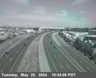
I-880 · Oakland, CA
Oakland - I-880 northbound at Adeline St, Oakland - View north 19 ft

I-880 · Oakland, CA
Oakland - I-880 southbound at Broadway off-ramp, Oakland - View south 9 ft

I-880 · Oakland, CA
Oakland - I-880 southbound at Broadway, Oakland - View south - MM 41.84 32 ft

I-880 · Oakland, CA
Oakland - I-880 southbound at Oak Street, Oakland - View south - MM 41.31 13 ft
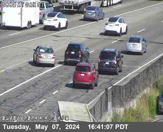
I-880 · Oakland, CA
Oakland - I-880 southbound at 16th Avenue Overcross, Oakland - View south - MM 39.93 6 ft
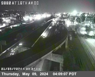
I-880 · Oakland, CA
Oakland - I-880 northbound North OF 23rd Ave, Oakland - View north - MM 39.31 22 ft
I-880 · Oakland, CA
Oakland - I-880 northbound at 23rd Ave, Oakland - View north - MM 39.32 22 ft

I-880 · Oakland, CA
Oakland - I-880 southbound at 23rd Ave/Kennedy St OR, Oakland - View south - MM 39.13 22 ft
I-880 · Oakland, CA
Oakland - I-880 southbound at 29th Ave, Oakland - View south - MM 38.91 29 ft
I-880 · Oakland, CA
Oakland - I-880 southbound just south of High St, Oakland - View south - MM 37.86 13 ft
I-880 · Oakland, CA
Oakland - I-880 northbound at 66th Ave Loop OR, Oakland - View north 16 ft

I-880 · Oakland, CA
Oakland - I-880 northbound at Hegenberger Rd, Oakland - View north - MM 35.71 13 ft
I-880 · Oakland, CA
Oakland - I-880 northbound at 98th Ave Loop OR, Oakland - View north 13 ft
I-880 · San Leandro, CA
San Leandro - I-880 northbound at Junction-112 Davis St, San Leandro - View north 22 ft
I-880 · San Leandro, CA
San Leandro - I-880 southbound at Davis St E112 Diagonal OR, San Leandro - View south 29 ft
I-880 · San Leandro, CA
San Leandro - I-880 northbound at Marina Blvd Loop OR, San Leandro - View north 29 ft
I-880 · San Leandro, CA
San Leandro - I-880 southbound at Marina Blvd, San Leandro - View south 26 ft
I-880 · San Leandro, CA
San Leandro - I-880 northbound just south of Marina Blvd, San Leandro - View north - MM 32.39 26 ft

I-880 · San Leandro, CA
San Leandro - I-880 southbound just north of SR-238, San Leandro - View south - MM 31.38 16 ft
I-880 · San Leandro, CA
San Leandro - I-880 northbound at Washington Ave Loop OR, San Leandro - View north 19 ft
I-880 · San Leandro, CA
San Leandro - I-880 southbound at Washington Ave OR, San Leandro - View south 22 ft
I-880 · San Leandro, CA
San Leandro - I-880 northbound at Lewelling Blvd, San Leandro - View north - MM 30.54 32 ft
I-880 · San Lorenzo, CA
San Lorenzo - I-880 southbound at Paseo Grande Overcross, San Lorenzo - View south - MM 30 29 ft
I-880 · San Lorenzo, CA
San Lorenzo - I-880 northbound just south of Hacienda, San Lorenzo - View north 39 ft

I-880 · San Lorenzo, CA
San Lorenzo - I-880 southbound at A St, San Lorenzo - View south 49 ft
I-880 · Hayward, CA
Hayward - I-880 southbound at Eldrige Avenue Pedestrian Overcross, Hayward - View south - MM 26.35 26 ft
I-880 · Union City, CA
Union City - I-880 northbound at Alvarado Niles, Union City - View north - MM 23.32 3 ft

I-880 · Fremont, CA
Fremont - I-880 southbound at Junction-84, Fremont - View south - MM 20.61 22 ft

I-880 · Newark, CA
Newark - I-880 southbound just north of Mowry Blvd, Newark - View south 32 ft

I-880 · Fremont, CA
Fremont - I-880 northbound at Mowry Ave, Fremont - View north 36 ft

I-880 · Newark, CA
Newark - I-880 southbound at Mowry Loop OR, Newark - View south - MM 17.432 42 ft

I-880 · Fremont, CA
Fremont - I-880 northbound at Stevenson Boulevard, Fremont - View north - MM 16.45 36 ft

I-880 · Fremont, CA
Fremont - I-880 southbound just north of Auto Mall Pkwy, Fremont - View south - MM 15.667 22 ft

I-880 · Fremont, CA
Fremont - I-880 southbound at S880 at Auto Mall Pkwy, Fremont - View south - MM 14.97 13 ft

I-880 · Fremont, CA
Fremont - I-880 southbound just south of Automall, Fremont - View south - MM 14.494 16 ft

I-880 · Fremont, CA
Fremont - I-880 northbound at Fremont Blvd Loop OR, Fremont - View north 13 ft

I-880 · Fremont, CA
Fremont - I-880 southbound just south of S Fremont, Fremont - View south 26 ft

I-880 · Fremont, CA
Fremont - I-880 northbound just north of Mission OR, Fremont - View north 19 ft

I-880 · Fremont, CA
Fremont - I-880 southbound just south of GATEWAY262, Fremont - View south - MM 11.366 6 ft

I-880 · San Jose, CA
San Jose - I-880 southbound at S101 at Junction 880, San Jose - View south 65 ft

I-880 · San Jose, CA
San Jose - I-880 northbound at North First Street, San Jose - View north 52 ft

I-880 · San Jose, CA
San Jose - I-880 southbound at The Alameda, San Jose - View south 55 ft

I-880 · San Jose, CA
San Jose - I-880 northbound at Bascom Ave, San Jose - View north 88 ft

I-880 · San Jose, CA
San Jose - I-880 southbound at Bascom Ave SB Loop Onramp, San Jose - View south 82 ft

I-880 · San Jose, CA
San Jose - I-880 northbound at Steven Creek Blvd, San Jose - View north 104 ft

I-880 · San Jose, CA
San Jose - I-880 northbound at SR-17 / I-280, San Jose - View north 121 ft

California State Route 260 · Oakland, CA
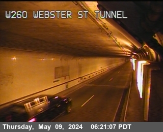
Oakland - CA-260 westbound at Webster St Tunnel Entrance, Oakland - View west - MM 1.2 19 ft
California State Route 260 · Alameda, CA
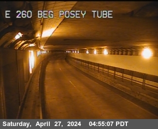
Alameda - CA-260 eastbound at Posey Tube Tunnel Entrance, Alameda - View east - MM 0.33 9 ft
I-280 · San Francisco, CA
San Francisco - I-280 northbound at 6th Street Offramp, San Francisco - View north - MM 57.2
I-280 · San Francisco, CA
San Francisco - I-280 northbound at Indiana St, San Francisco - View north - MM 55.99 13 ft
I-280 · San Francisco, CA
San Francisco - I-280 southbound at Cesar Chavez, San Francisco - View south - MM 55.612 3 ft

I-280 · San Francisco, CA
San Francisco - I-280 southbound just south of Cesar Chavez, San Francisco - View south - MM 55.26 3 ft
I-280 · San Francisco, CA
San Francisco - I-280 northbound just south of Cesar Chavez, San Francisco - View north - MM 55.01 6 ft
I-280 · San Francisco, CA
San Francisco - I-280 southbound at On Monterey Blvd, San Francisco - View south - MM 52.64 180 ft
I-280 · San Francisco, CA
San Francisco - I-280 northbound at Sickles Ave, San Francisco - View north - MM 50.77 295 ft

I-280 · San Francisco, CA
San Francisco - I-280 southbound at John Daly Blvd, San Francisco - View south - MM 50.2 282 ft
I-280 · Daly City, CA
Daly City - I-280 northbound at Serramonte Blvd Northbound on-ramp, Daly City - View north - MM 47.23 196 ft
I-280 · San Bruno, CA
San Bruno - I-280 at Sneath Ln NB Loop Onramp, San Bruno - MM 43.827 193 ft

I-280 · Hillsborough, CA
Hillsborough - I-280 northbound at SOF Canada Rd, Hillsborough - View north - MM 37.557 666 ft

I-280 · Cupertino, CA
Cupertino - I-280 southbound at S280 at De Anza OR, Cupertino - View south - MM 10.8 219 ft
I-280 · Sunnyvale, CA
Sunnyvale - I-280 southbound just south of SR-85, Sunnyvale - View south - MM 11.88 269 ft
I-280 · Sunnyvale, CA
Sunnyvale - I-280 southbound just north of Junction-85, Sunnyvale - View south - MM 12.154 298 ft

I-280 · San Jose, CA
San Jose - I-280 southbound at 10th Street, San Jose - View south 111 ft

I-280 · Santa Clara, CA
Santa Clara - I-280 northbound at Stevens Creek on-ramp, Santa Clara - View north - MM 8.77 170 ft

I-280 · San Jose, CA
San Jose - I-280 southbound at Lawrence Expressway Southbound on-ramp, San Jose - View south - MM 8.5 167 ft

I-280 · San Jose, CA
San Jose - I-280 northbound at Junction-880/17, San Jose - View north 108 ft

I-280 · San Jose, CA
San Jose - I-280 southbound at Saratoga Avenue on-ramp, San Jose - View south - MM 7.33 131 ft

I-280 · San Jose, CA
San Jose - I-280 northbound at Winchester Blvd OR, San Jose - View north 134 ft

I-205 · Mountain House, CA
Mountain House - I-205 eastbound at Junction I-580, Mountain House - View east 301 ft

California State Route 238 · Ashland, CA
Ashland - CA-238 southbound north of Ashland Undercross, Ashland - View south - MM 11.16 39 ft
California State Route 238 · Ashland, CA
Ashland - CA-238 northbound south of Ashland Avenue, Ashland - View north - MM 11.15 39 ft
California State Route 1 · Daly City, CA
Daly City - CA-1 southbound at Nof 280 Itc, Daly City - View south 456 ft

California State Route 1 · Pacifica, CA
Pacifica - CA-1 northbound at Nof Reina Del Mar Ave, Pacifica - View north - MM 420.208 104 ft

California State Route 1 · El Granada, CA
El Granada - CA-1 northbound at Capistrano Road, El Granada - View north - MM 412.72 29 ft
California State Route 92 · Hayward, CA
Hayward - CA-92 eastbound just west of I-880, Hayward - View east - MM 25.77 52 ft
California State Route 92 · Hayward, CA
Hayward - CA-92 eastbound just east of Industrial Blvd, Hayward - View east 19 ft
California State Route 92 · Hayward, CA
Hayward - CA-92 eastbound just west of Industrial Blvd, Hayward - View east - MM 24.43 16 ft

California State Route 92 · Hayward, CA
Hayward - CA-92 eastbound at Clawiter Rd, Hayward - View east - MM 23.885 13 ft

California State Route 92 · Hayward, CA
Hayward - CA-92 eastbound just west of OF Clawiter Rd, Hayward - View east - MM 23.001

California State Route 92 · Hayward, CA
Hayward - CA-92 eastbound just east of San Mateo Bridge Toll Plaza, Hayward - View east - MM 22.41

California State Route 92 · Foster City, CA
Foster City - CA-92 eastbound at San Mateo Bridge Substation 3, Foster City - View east - MM 17.03

California State Route 92 · Foster City, CA
Foster City - CA-92 eastbound just west of Foster City Blvd, Foster City - View east - MM 13.96 19 ft

California State Route 92 · San Mateo, CA
San Mateo - CA-92 westbound at S Delaware St, San Mateo - View west 9 ft

California State Route 92 · San Mateo, CA
San Mateo - CA-92 eastbound at 82 Ic, San Mateo - View east - MM 11.957 19 ft

California State Route 92 · San Mateo, CA
San Mateo - CA-92 eastbound at Ralston Ave, San Mateo - View east 498 ft

I-380 · San Bruno, CA
San Bruno - I-380 eastbound just east of EL Camino Real, San Bruno - View east - MM 0.84 62 ft
California State Route 84 · Pleasanton, CA
Pleasanton - CA-84 southbound at Vallecitos Rd, Pleasanton - View south 574 ft

California State Route 84 · Livermore, CA
Livermore - CA-84 westbound at Vallecitos Rd, Livermore - View west 561 ft

California State Route 84 · Livermore, CA
Livermore - CA-84 northbound at Vallecitos Rd, Livermore - View north 567 ft

California State Route 84 · Pleasanton, CA
Pleasanton - CA-84 eastbound at Vallecitos Rd, Pleasanton - View east 583 ft

California State Route 84 · Newark, CA
Newark - CA-84 southbound at W84 at Newark Blvd, Newark - View south - MM 34.95 26 ft

California State Route 84 · Newark, CA
Newark - CA-84 southbound at Thornton Ave, Newark - View south 13 ft

California State Route 84 · Fremont, CA
Fremont - CA-84 westbound just west of Toll Plaza, Fremont - View west

California State Route 84 · Fremont, CA
Fremont - CA-84 southbound at KGO Towers, Fremont - View south 3 ft

California State Route 84 · Fremont, CA
Fremont - CA-84 at W84 at Midspan Sub 23, Fremont

California State Route 84 · Menlo Park, CA
Menlo Park - CA-84 southbound at PG&E Substation, Menlo Park - View south - MM 28.584 9 ft

California State Route 84 · Menlo Park, CA
Menlo Park - CA-84 northbound east of Chrysler Drive, Menlo Park - View north - MM 26.32 3 ft

California State Route 84 · Menlo Park, CA
Menlo Park - CA-84 southbound at EOF Chilco St, Menlo Park - View south - MM 27.107 3 ft

California State Route 114 · Menlo Park, CA
Menlo Park - CA-114 westbound at W114 at Newbridge St, Menlo Park - View west - MM 0.25 13 ft

California State Route 82 · Palo Alto, CA
Palo Alto - CA-82 northbound at Embarcadero, Palo Alto - View north - MM 15.72 52 ft

California State Route 82 · Stanford, CA
Stanford - CA-82 westbound at Embarcadero, Stanford - View west - MM 15.74 55 ft

California State Route 82 · Palo Alto, CA
Palo Alto - CA-82 eastbound at Embarcadero, Palo Alto - View east - MM 15.71 52 ft

California State Route 82 · Stanford, CA
Stanford - CA-82 southbound at Embarcadero, Stanford - View south - MM 15.72 52 ft

California State Route 237 · Milpitas, CA
Milpitas - CA-237 westbound at McCarthy, Milpitas - View west - MM 9.02 26 ft

California State Route 237 · San Jose, CA
San Jose - CA-237 westbound at North First Street, San Jose - View west - MM 6.94

California State Route 237 · Sunnyvale, CA
Sunnyvale - CA-237 westbound just west of Lawrence Expressway, Sunnyvale - View west - MM 4.57 9 ft

California State Route 237 · Sunnyvale, CA
Sunnyvale - CA-237 eastbound at E237 Lawrence Expwy OR, Sunnyvale - View east - MM 4.7 6 ft

California State Route 85 · Mountain View, CA
Mountain View - CA-85 northbound at US-101, Mountain View - View north - MM 23.81 49 ft

California State Route 85 · Mountain View, CA
Mountain View - CA-85 southbound at S85 at Moffet Blvd, Mountain View - View south - MM 23.63 59 ft

California State Route 85 · Mountain View, CA
Mountain View - CA-85 northbound at Central Expy, Mountain View - View north - MM 23.133 72 ft

California State Route 85 · Mountain View, CA
Mountain View - CA-85 southbound at Evelyn Ave OR, Mountain View - View south - MM 22.78 91 ft

California State Route 85 · Mountain View, CA
Mountain View - CA-85 southbound at Junction 237, Mountain View - View south 118 ft

California State Route 85 · Cupertino, CA
Cupertino - CA-85 southbound at Stevens Creek Blvd, Cupertino - View south - MM 17.87 305 ft
California State Route 85 · Saratoga, CA
Saratoga - CA-85 northbound at Saratoga VA OR, Saratoga - View north - MM 13.84 285 ft
California State Route 85 · Saratoga, CA
Saratoga - CA-85 southbound at Saratoga Ave, Saratoga - View south - MM 13.827 308 ft

California State Route 85 · Los Gatos, CA
Los Gatos - CA-85 northbound at Winchester Blvd, Los Gatos - View north - MM 11.175 265 ft

California State Route 85 · San Jose, CA
San Jose - CA-85 northbound at Almaden Express WAY, San Jose - View north 193 ft

California State Route 85 · Los Gatos, CA
Los Gatos - CA-85 southbound at Junction 17, Los Gatos - View south 275 ft

California State Route 85 · San Jose, CA
San Jose - CA-85 northbound at Union Ave, San Jose - View north 229 ft

California State Route 85 · San Jose, CA
San Jose - CA-85 northbound at Camden Ave, San Jose - View north 196 ft

California State Route 85 · San Jose, CA
San Jose - CA-85 southbound at Blossom Hill Rd Diag TO, San Jose - View south 164 ft

California State Route 85 · San Jose, CA
San Jose - CA-85 northbound at Great Oaks Blvd, San Jose - View north 200 ft

California State Route 87 · San Jose, CA
San Jose - CA-87 southbound at Skyport Dr, San Jose - View south 45 ft

California State Route 87 · San Jose, CA
San Jose - CA-87 northbound at Almaden Expressway, San Jose - View north 121 ft

California State Route 17 · Los Gatos, CA
Los Gatos - CA-17 southbound at Lark Ave, Los Gatos - View south - MM 21.51 262 ft

California State Route 17 · Los Gatos, CA
Los Gatos - CA-17 northbound at Lark Offramp, Los Gatos - View north - MM 21.42 291 ft

California State Route 17 · Los Gatos, CA
Los Gatos - CA-17 northbound at Saratoga Road, Los Gatos - View north - MM 19.64 334 ft
California State Route 17 · Los Gatos, CA
Los Gatos - CA-17 southbound at Santa Cruz Ave, Los Gatos - View south - MM 18.771 413 ft

California State Route 17 · Lexington Hills, CA
Lexington Hills - CA-17 northbound at Bear Creek Rd, Lexington Hills - View north - MM 16.66 672 ft
California State Route 17 · Lexington Hills, CA
Lexington Hills - CA-17 southbound at Brush Rd, Lexington Hills - View south 1,236 ft

California State Route 17 · Lexington Hills, CA
Lexington Hills - CA-17 southbound at Jessie WY, Lexington Hills - View south 1,492 ft

California State Route 17 · Lexington Hills, CA
Lexington Hills - CA-17 northbound at Alma Court, Lexington Hills - View north 1,643 ft
California State Route 17 · Lexington Hills, CA
Lexington Hills - CA-17 southbound at LOS Gatos Farms Dr, Lexington Hills - View south 1,683 ft
California State Route 152
CA-152 eastbound at Dinosaur Point, Santa Clara County - View east - MM 45.807 1,371 ft

California State Route 152
CA-152 eastbound west of Casa de Fruta, Santa Clara County - View east - MM 33.38 252 ft
