Traffic cameras from I-25 as it passes through Denver
Right now on I-25 through Denver (Sat 4:37 pm MT): 4 lane closures in effect.
Comparing with the usual for this hour starts once we have a few days of readings. COtrip, 4:37 pm MT
CDOT plows driving here now: b851 heading southeast, 13 min ago CDOT plow tracker
Yes. In effect now: Left lane and toll lanes closed (southbound), near 84th Ave (mile 218) until Mon 6:00 am; Right entrance ramp closed (southbound), near Ridgegate Pkwy (mile 192.8) until Wed 8:00 pm; Right entrance ramp closed (southbound), near Ridgegate Pkwy (mile 192.8) until Sun 11:59 pm; Right exit ramp closed (northbound), near Ridgegate Pkwy (mile 192.7) until Sun 11:59 pm. COtrip, 4:37 pm MT
None reported by COtrip right now. COtrip, 4:37 pm MT
COtrip lists 14 planned closures on this stretch in the next 7 days, 12 of them overnight. First: Mon 4:00 am to Mon 9:00 am, Left lane closed (southbound), near Ridgegate Pkwy (mile 192.2). COtrip, 4:37 pm MT
It starts at 0 and adds points for what COtrip lists on I-25 from RidgeGate Parkway to Northwest Parkway right now: incidents (minor 1, moderate 2, major 3, plus 1 for a crash and 3 if it closes the road), lane closures in effect (2 for the first, 1 for each more), work zones with lanes closed (1 or 2), and road conditions (closed 6, chain law 2, snow or ice 2, fog 1). The top is 10. It reads CDOT reports, not measured speed, so a quiet score can still be a slow drive. This is the first version of the rules.
I-25 · Brighton, CO
Brighton - 0.5 mi N of Northwest Pkwy - View north - MM 228.25

I-25 · Brighton, CO
Brighton - 0.7 mi S of Northwest Pkwy - View south - MM 227.05


I-25 · Broomfield, CO
Broomfield - I-25 MP 221.95 SB : 0.9 miles N of E 104th Ave - View south - MM 221.95

I-25 · Broomfield, CO
Broomfield - I-25 MP 221.00 SB at E 104th Ave - View south - MM 221.0

I-25 · Commerce City, CO
Commerce City - I-25 MP 220.55 SB : 0.5 miles S of E 104th Ave - View south - MM 220.55

I-25 · Commerce City, CO
Commerce City - I-25 MP 220.30 NB : 0.4 miles N of Thornton Pkwy - View north - MM 220.3

I-25 · Commerce City, CO
Commerce City - I-25 MP 219.85 NB at Thornton Pkwy - View north - MM 219.85

I-25 · Commerce City, CO
Commerce City - I-25 MP 219.50 SB : 0.4 miles S of Thornton Pkwy - View south - MM 219.5

I-25 · Commerce City, CO
Commerce City - I-25 MP 218.75 SB : 0.3 miles N of 84th Ave - View south - MM 218.75

I-25 · Commerce City, CO
Commerce City - I-25 MP 218.30 SB : 0.2 miles S of 84th Ave - View south - MM 218.3

I-25 · Commerce City, CO
Commerce City - I-25 MP 217.95 SB : 0.5 miles S of 84th Ave - View south - MM 217.95

I-25 · Commerce City, CO
Commerce City - I-25 MP 217.60 NB : 0.6 miles N of US 36/I-270 - View north - MM 217.6

I-25 · Commerce City, CO
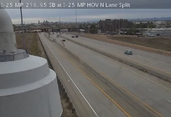
Commerce City - I-25 MP 216.95 SB at I-25 HOV N Lane Split - View south - MM 216.95

I-25 · Commerce City, CO
Commerce City - I-25 MP 216.95 SB at I-25 HOV N Lane Split - View south - MM 216.95
I-25 · Commerce City, CO
Commerce City - I-25 MP 215.80 NB : 0.6 miles N of E 58th Ave - View north - MM 215.8

I-25 · Commerce City, CO
Commerce City - I-25 MP 215.40 NB : 0.1 miles N of E 58th Ave - View north - MM 215.4

I-25 · Commerce City, CO
Commerce City - I-25 MP 214.85 SB : 0.4 miles S of E 58th Ave - View south - MM 214.85

I-25 · Denver, CO
Denver - I-25 MP 213.95 NB : 0.2 miles N of I-70 - View north - MM 213.95

I-25 · Denver, CO
Denver - I-25 MP 213.70 SB at WB I-70 Ramp to SB I-25 - View south - MM 213.7

I-25 · Denver, CO
Denver - I-25 MP 213.65 NB : NB I-25 Ramp to WB I-70 - View north - MM 213.65

I-25 · Denver, CO
Denver - I-25 MP 213.40 NB : 0.3 miles S of I-70 - View north - MM 213.4

I-25 · Denver, CO
Denver - I-25 MP 212.90 NB : 0.1 miles N of W 38th Ave/Park Ave - View north - MM 212.9

I-25 · Denver, CO
Denver - I-25 MP 212.70 NB at W 38th Ave/Park Ave - View north - MM 212.7


I-25 · Denver, CO
Denver - I-25 MP 212.05 NB at 19th St and Wynkoop St - View north - MM 212.05

I-25 · Denver, CO
Denver - I-25 MP 211.65 NB : 0.2 miles N of Speer Blvd - View north - MM 211.65

I-25 · Denver, CO
Denver - I-25 MP 212.10 NB at 20th St and Market St - View north - MM 212.1

I-25 · Denver, CO
Denver - I-25 MP 211.10 SB at W 23rd Ave - View south - MM 211.1

I-25 · Denver, CO
Denver - I-25 MP 210.90 NB at 20th Ave/Mile High Stadium Cir - View north - MM 210.9


I-25 · Denver, CO
Denver - I-25 MP 209.15 NB at 6th Ave/US 6 - View north - MM 209.15

I-25 · Denver, CO
Denver - I-25 MP 208.75 NB : 0.6 miles S of 6th Ave - View north - MM 208.75

I-25 · Denver, CO
Denver - I-25 MP 208.10 SB : 0.2 miles N of W Alameda Ave - View south - MM 208.1


I-25 · Denver, CO
Denver - I-25 MP 207.70 NB : 0.1 miles N of Santa Fe Dr - View north - MM 207.7

I-25 · Denver, CO
Denver - I-25 MP 207.40 SB : 0.2 miles S of Santa Fe Dr - View south - MM 207.4

I-25 · Denver, CO
Denver - I-25 MP 206.65 NB at S Logan St - View north - MM 206.65

I-25 · Denver, CO
Denver - I-25 MP 206.40 NB : 0.3 miles S of S Logan St - View north - MM 206.4

I-25 · Denver, CO
Denver - I-25 MP 206.00 SB : 0.2 miles N of S Downing St - View south - MM 206.0

I-25 · Denver, CO
Denver - I-25 MP 205.90 NB at S Downing St - View north - MM 205.9

I-25 · Denver, CO
Denver - I-25 MP 205.40 SB : 0.4 miles N of S University Blvd - View south - MM 205.4

I-25 · Denver, CO
Denver - I-25 MP 204.95 NB : 0.1 miles S of S University Blvd - View north - MM 204.95

I-25 · Denver, CO
Denver - I-25 MP 204.05 NB at Colorado Blvd/CO 2 - View north - MM 204.05

I-25 · Denver, CO
Denver - I-25 MP 203.85 NB : 0.2 miles S of Colorado Blvd/CO 2 - View north - MM 203.85


I-25 · Denver, CO
Denver - I-25 MP 202.70 NB at E Yale Ave - View north - MM 202.7

I-25 · Littleton, CO
Littleton - I-25 MP 201.55 SB at E Hampden Ave - View south - MM 201.55

I-25 · Littleton, CO
Littleton - I-25 MP 200.65 NB : 0.5 miles N of I-225 - View north - MM 200.65

I-25 · Littleton, CO
Littleton - I-25 MP 200.45 SB at E Quincy Ave - View south - MM 200.45

I-25 · Littleton, CO
Littleton - I-25 MP 200.10 SB : SB I-25 Ramp to NB I-225/DTC Blvd - View south - MM 200.1

I-25 · Littleton, CO
Littleton - I-25 MP 199.40 NB at E Belleview Ave NB I-25 Ramp - View north - MM 199.4

I-25 · Littleton, CO
Littleton - I-25 MP 199.45 SB at E Belleview Ave - View south - MM 199.45

I-25 · Littleton, CO
Littleton - I-25 MP 198.20 NB at E Orchard Rd - View north - MM 198.2

I-25 · Littleton, CO
Littleton - I-25 MP 197.65 NB : 0.6 miles N of E Arapahoe Rd - View north - MM 197.65

I-25 · Parker, CO
Parker - I-25 MP 196.25 NB : 0.1 miles N of E Dry Creek - View north - MM 196.25

I-25 · Parker, CO
Parker - I-25 MP 195.10 NB at E County Line Rd - View north - MM 195.1

I-25 · Parker, CO
Parker - I-25 MP 194.40 SB : SB I-25 Ramp to EB E-470 - View south - MM 194.4

I-25 · Parker, CO
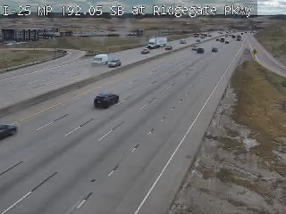
Parker - I-25 MP 192.05 SB at Ridgegate Pkwy - View south - MM 192.05
I-25 · Parker, CO
Parker - I-25 MP 191.40 NB : 0.7 miles S of Ridgegate Pkwy - View north - MM 191.4

I-270 · Commerce City, CO
Commerce City - I-270 MP 002.40 EB at Vasquez Blvd - View east - MM 2.4

US 6 · Denver, CO
Denver - US 6 MP 284.40 EB : SB I-25 Ramp to WB 6th Ave - View east - MM 284.4

★ My Cams Cameras you star, kept in this browser
More JamJumper:
 JamJumper