438 .5
Rose Ave looking east I-70 MP 438.45 EB : 0.2 miles E of Rose Ave in Burlington
⋮ 10 mi 428 .9
CR 40 to EB I-70 Ramp looking east I-70 MP 428.85 EB at CR 40 to EB I-70 Ramp in Bethune
⋮ 9 mi 419 .9
Colorado Ave looking east I-70 MP 419.85 EB : 0.5 miles E of Colorado Ave/Rd 30.5 in Stratton
⋮ 15 mi 405 .1
CO-59 Ramp to EB I-70 looking east, Between towns I-70 MP 405.05 Ebb at CO-59 Ramp to EB I-70 in Seibert
⋮ 22 mi 383 .5
CR 43 to EB I-70 Ramp looking east I-70 MP 383.50 EB at CR 43 to EB I-70 Ramp in Arriba - MM 383.5
⋮ 12 mi 371 .5
R 31 CR 31 looking east I-70 MP 371.50 EB at CR 31/CR 109 in Genoa - MM 371.5
Limon CO · 10 cams ⋮ 6 mi I-70 MP 365.30 EB : 2.9 miles E of US 40/US 287 on Frontage Rd in Limon - MM 365.3
I-70 MP 362.90 EB : 0.2 miles E of US 40/US 287 in Limon - MM 362.9
looking east I-70 MP 362.90 EB : 0.2 miles E of US 40/US 287 in Limon - MM 362.9
looking west I-70 MP 362.90 EB : 0.2 miles E of US 40/US 287 in Limon - MM 362.9
I-70 MP 362.30 WB : 0.5 miles E of US 40/US 287W in Limon - MM 362.3
358 .6
Williams Ave looking west I-70 MP 358.55 WB : 1.2 miles W of Williams Ave in Limon
⋮ 6 mi I-70 MP 352.35 WB at CO 86/Cedar Point
looking east I-70 MP 352.35 WB at CO 86/Cedar Point
looking south I-70 MP 352.35 WB at CO 86/Cedar Point
looking west I-70 MP 352.35 WB at CO 86/Cedar Point
⋮ 12 mi 340 .4
EB I-70 in Agate looking east I-70 MP 340.35 EB at CR 166 Ramp to EB I-70 in Agate
⋮ 12 mi 328 .7
Cedar St looking east I-70 MP 328.65 EB : 0.3 miles E of Cedar St in Deer Trail
⋮ 8 mi 320 .9
Peoria Rd looking east I-70 MP 320.90 EB : 1.6 miles W of Peoria Rd/CR 201 - MM 320.9
⋮ 12 mi 309 .3
Wagner St looking west I-70 MP 309.30 WB : 0.9 miles W of Wagner St in Strasburg - MM 309.3
306 .4
R 2 CR 2 looking east I-70 MP 306.40 EB : 0.8 miles E of CR 2/15th Ave in Bennett - MM 306.4
304 .4
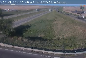
S 1st St Bennett I-70 MP 304.35WB at S 1st St Bennett - MM 304.35
302 .3
S 1st St looking east I-70 MP 302.30 EB : 2.6 miles W of S 1st St in Bennett - MM 302.3
299 .4
N Manila Rd looking east I-70 MP 299.35 EB at N Manila Rd in Bennett
297 .4
Watkins Rd looking east I-70 MP 297.35 EB : 2.7 miles E of Watkins Rd
296 .3
Watkins Rd looking east I-70 MP 296.25 EB : 1.3 miles E of Watkins Rd
293 .7
36 CO-36 looking east I-70 MP 293.65 EB : 1.9 miles E of CO-36 in Aurora
291 .1
Powhaton Rd looking east I-70 MP 291.10 EB : 0.1 miles W of Powhaton Rd - MM 291.1
289 .2
E-470 looking east I-70 MP 289.15 EB at EB I-70 Ramp to E-470
288 .6
E-470 looking east I-70 MP 288.55 EB : 0.4 miles W of E-470
I-70 MP 285.20 EB : 0.5 miles W of Tower Rd - MM 285.2
284 .6
N Airport Blvd looking west I-70 MP 284.60 WB at N Airport Blvd - MM 284.6
Looking over I-70 at I-225 - MM 284
looking east Looking over I-70 - MM 284
looking north Looking over Chambers Road - MM 284
looking south Looking over Chambers Road - MM 284
283 .6
Pena Blvd Ramp looking east I-70 MP 283.55 EB at Pena Blvd Ramp
I-70 MP 283.50 WB at Chambers Rd - MM 283.5
I-70 MP 282.20 WB : 0.4 miles W of I-225 - MM 282.2
281 .6
Peoria St Underpass looking west I-70 MP 281.55 WB at Peoria St Underpass
281 .5
Peoria St looking east I-70 MP 281.50 EB at Peoria St - MM 281.5
281 .1
Havana St looking east I-70 MP 281.05 EB : 0.6 miles E of Havana St
280 .6
Havana St Underpass looking west I-70 MP 280.60 WB at Havana St Underpass - MM 280.6
279 .6
Central Park Blvd looking east I-70 MP 279.60 EB at Central Park Blvd - MM 279.6
I-70 MP 278.90 EB at I-270 - MM 278.9
I-70 MP 278.55 WB at Quebec St
looking west I-70 MP 278.40 WB : 0.2 miles W of Quebec St - MM 278.4
Looking over Quebec Street - MM 278
looking north Looking over Quebec Street - MM 278
looking east Looking over I-70 - MM 278
looking west Looking over I-70 - MM 278
I-70 MP 277.50 EB at Holly St - MM 277.5
I-70 MP 277.05 WB at Dahlia St
I-70 MP 276.60 EB at Colorado Blvd to EB I-70 Ramp - MM 276.6
I-70 MP 276.55 WB at Colorado Blvd to WB I-70 Ramp
I-70 MP 276.35 EB at Monroe St Overpass
I-70 MP 276.05 WB at Steele St to WB I-70 Ramp
I-70 MP 276.05 WB at SB Steele St Ramp to WB I-70
I-70 MP 275.55 EB at York St
I-70 MP 275.25 EB at Brighton Blvd
looking west I-70 MP 275.20 WB : 0.1 miles W of Brighton Blvd - MM 275.2
Looking over Brighton Blvd - MM 275
looking north Looking over Brighton Blvd - MM 275
looking east Looking over I-70 - MM 275
looking west Looking over I-70 - MM 275
I-70 MP 274.75 WB : 0.1 miles E of Washington St
looking east I-70 MP 274.60 EB at Washington St - MM 274.6
I-70 MP 274.10 EB at I-25 - MM 274.1
I-70 MP 274.00 EB at Washington St and SB I-25 Ramps
I-70 MP 273.95 WB at SB I-25 to EB I-70 Ramp
I-70 MP 273.65 EB : 0.4 miles W of I-25
I-70 MP 273.05 EB at N Pecos St
looking west I-70 MP 272.80 WB : 0.3 miles W of N Pecos St - MM 272.8
I-25 MP 213.95 NB : 0.2 miles N of I-70
looking north I-25 MP 213.40 NB : 0.3 miles S of I-70
I-70 MP 271.35 WB : 0.2 miles W of Lowell Blvd
I-70 MP 270.30 WB : 0.3 miles E of N Harlan St - MM 270.3
Looking over I-70 - MM 270
looking west Looking over I-70 - MM 270
looking south Looking over Sheridan Blvd - MM 270
looking north Looking over Sheridan Blvd - MM 270
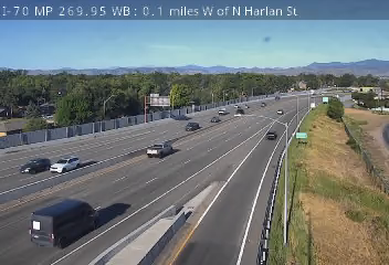
I-70 MP 269.95 WB : 0.1 miles W of N Harlan St
I-70 MP 269.35 WB at WB I-76 to WB I-70 Ramp
I-70 MP 268.95 WB at Wadsworth Blvd
I-70 MP 268.05 WB : 0.9 miles W of Kipling St
I-70 MP 267.40 EB at Kipling St to EB I-70 Ramp - MM 267.4
I-70 MP 267.40 WB at EB I-70 Ramp to Kipling St - MM 267.4
I-70 MP 266.95 WB : 0.4 miles W of Kipling St
I-70 MP 266.05 EB at EB I-70 Ramp to W 44th Ave
I-70 MP 265.70 WB at Ward Rd - MM 265.7
I-70 MP 264.70 WB : 0.4 miles E of W 32nd Ave - MM 264.7
I-70 MP 264.15 EB : 0.2 miles W of W 32nd Ave
I-70 MP 263.50 EB : 1.2 miles E of Denver West Colorado Mills Pkwy - MM 263.5
I-70 MP 261.65 WB at W Colfax Ave
I-70 MP 260.85 EB : 0.2 miles W of W 6th Ave
US 6 MP 275.85 EB : 0.3 miles E of I-70
I-70 MP 260.15 EB : 0.1 miles E of C-470
I-70 MP 259.75 WB at C-470
looking east, Morrison C-470 MP 000.45 EB : 0.5 miles E of I-70
I-70 MP 259.10 WB : 0.3 miles E of US 40/CR 93 in Golden - MM 259.1
C-470 MP 000.05 WB at I-70
I-70 MP 258.75 EB at EB I-70 Ramp to CR 93 in Golden
I-70 MP 257.30 EB : 1.3 miles E of Lookout Mountain - MM 257.3
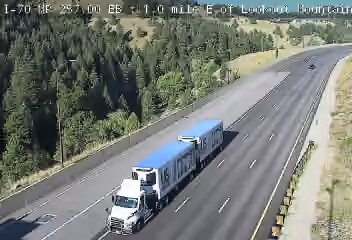
I-70 MP 257.00 EB : 1.0 mile E of Lookout Mountain
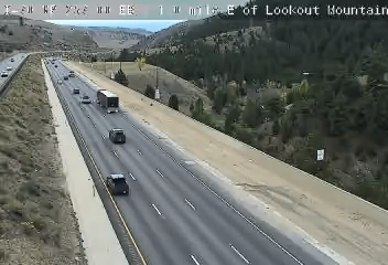
looking east, Golden I-70 MP 257.00 EB : 1.0 mile E of Lookout Mountain
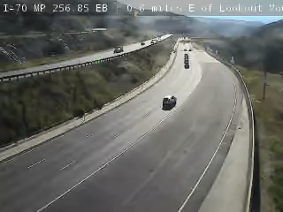
looking east I-70 MP 256.85 EB : 0.8 miles E of Lookout Mountain
I-70 MP 256.60 WB : 0.6 miles E of Lookout Mountain - MM 256.6
I-70 MP 256.00 WB at Lookout Mountain
I-70 MP 254.65 WB : 1.1 miles E of Genesee Park
I-70 MP 253.95 EB : 0.4 miles E of Genesee Park
I-70 MP 253.55 WB at Genesee Park
I-70 MP 251.65 EB : 0.3 miles E of in Evergreen Pkwy in Evergreen
I-70 MP 250.75 EB at El Rancho in Evergreen
I-70 MP 250.15 WB : 0.8 miles W of El Rancho in Evergreen
I-70 MP 249.10 WB : 1.4 miles E of CR 65 - MM 249.1
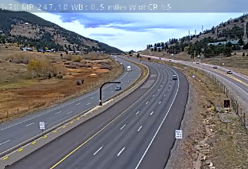
I-70 MP 247.60 EB at CR 65 E in Beaver Brook - MM 247.6
I-70 MP 247.10 WB : 0.5 miles W of CR 65 - MM 247.1
I-70 MP 246.60 EB at Homestead Rd W - MM 246.6
I-70 MP 246.40 WB : 0.2 miles W of Homestead Rd in Beaver Brook - MM 246.4
245 .9
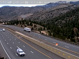
Homestead Rd looking east I-70 MP 245.90 EB : 0.8 miles W of Homestead Rd - MM 245.9
I-70 MP 245.40 WB : 1.2 miles E of US 6/US 40 - MM 245.4
I-70 MP 244.35 EB at US 6/US 40
US 6 MP 257.85 EB : 0.6 miles E of I-70
I-70 MP 243.25 WB : 0.3 miles E of Central City Pkwy
242 .9
Central City Pkwy looking west I-70 MP 242.85 WB : 0.2 miles W of Central City Pkwy
I-70 MP 242.45 WB at E Veterans Memorial Tunnels
242 .0
Veterans Memorial Tunnels looking east I-70 MP 242.00 EB : 0.2 miles W of Veterans Memorial Tunnels
241 .7
Veterans Memorial Tunnels looking east I-70 MP 241.65 EB : 0.6 miles W of Veterans Memorial Tunnels
I-70 MP 241.05 WB at Colorado Blvd E Exit in Idaho Springs
I-70 MP 240.60 WB : 0.5 miles W of Colorado Blvd E Exit in Idaho Springs - MM 240.6
I-70 MP 239.65 EB at CO 103/13th Ave in Idaho Springs
I-70 MP 239.15 WB : 0.3 miles E of Stanley Rd/CR 312
I-70 MP 239.00 EB : 0.1 miles E of Stanley Rd/CR 312
looking east I-70 MP 238.90 EB at Stanley Rd/CR 312 in Idaho Springs - MM 238.9
I-70 MP 238.50 WB : 0.5 miles W of Stanley Rd/CR 312 - MM 238.5
I-70 MP 238.05 EB : 0.3 miles E of Fall River Rd
I-70 MP 237.65 EB at Fall River Rd
I-70 MP 237.25 EB : 0.4 miles W of Fall River Rd
I-70 MP 236.55 EB : 1.1 miles W of Fall River Rd
I-70 MP 235.85 WB : 0.8 miles E of Stanley Rd in Dumont
I-70 MP 235.50 EB : 0.6 miles E of Stanley Rd in Dumont - MM 235.5
I-70 MP 235.00 WB at Stanley Rd in Dumont
I-70 MP 234.20 EB at Mountain St in Dumont - MM 234.2
I-70 MP 233.65 WB : 0.7 miles W of Mountain St in Dumont
I-70 MP 233.30 WB : 0.9 miles W of Mountain St in Dumont - MM 233.3
I-70 MP 232.60 WB : 0.7 miles E of US 40 - MM 232.6
I-70 MP 231.90 EB at US 40 - MM 231.9
looking east I-70 MP 231.75 EB : 0.1 miles W of US 40
I-70 MP 231.25 WB : 0.6 miles W of US 40
I-70 MP 230.45 EB : 1.4 miles W of US 40
I-70 MP 229.60 WB : 1.7 miles E of 15th St in Georgetown - MM 229.6
I-70 MP 228.80 WB : 0.9 miles E of 15th St in Georgetown - MM 228.8
I-70 MP 228.60 WB at Georgetown Truck Parking E - MM 228.6
I-70 MP 228.50 WB at Georgetown Truck Parking W - MM 228.5
I-70 MP 228.00 WB : 0.1 miles E of 15th St in Georgetown
I-70 MP 227.00 EB : 0.9 miles W of 15th St in Georgetown
I-70 MP 226.50 EB : 0.9 miles E of Woodward St in Silver Plume - MM 226.5
I-70 MP 225.80 WB : 0.1 miles E of Woodward St in Silver Plume - MM 225.8
I-70 MP 225.50 WB : 0.2 miles W of Woodward St in Silver Plume - MM 225.5
I-70 MP 224.05 WB : 2.0 miles W of Woodward St in Silver Plume
I-70 MP 223.35 WB : 2.1 miles E of Stevens Gulch Rd in Bakerville
looking west I-70 MP 223.20 WB : 1.9 miles E of Stevens Gulch Rd in Bakerville - MM 223.2
I-70 MP 222.40 WB : 1.2 miles E of Stevens Gulch Rd in Bakerville - MM 222.4
looking west I-70 MP 222.25 WB : 1.1 miles E of Stevens Gulch Rd in Bakerville
I-70 MP 221.30 EB at Stevens Gulch Rd in Bakerville - MM 221.3
I-70 MP 220.45 WB : 0.9 miles W of Stevens Gulch Rd in Bakerville
I-70 MP 219.70 WB : 1.3 miles E of Herman Gulch Rd - MM 219.7
I-70 MP 218.60 WB : 0.2 miles E of Herman Gulch Rd - MM 218.6
I-70 MP 217.85 EB : 0.6 miles W of Herman Gulch Rd
I-70 MP 217.40 WB : 1.0 mile W of Herman Gulch Rd - MM 217.4
I-70 MP 215.90 WB : 0.7 miles E of Eisenhower Tunnel - MM 215.9
I-70 MP 215.60 EB : 0.3 miles E of Eisenhower Tunnel - MM 215.6
I-70 MP 213.45 EB : 0.1 miles W of Eisenhower Tunnel
looking east I-70 MP 213.45 EB : 0.1 miles W of Eisenhower Tunnel
I-70 MP 211.80 WB : 1.7 miles W of Eisenhower Tunnel - MM 211.8
I-70 MP 210.65 EB : 2.9 miles W of Eisenhower Tunnel
I-70 MP 209.85 WB : 3.8 miles W of Eisenhower Tunnel
I-70 MP 208.90 WB : 3.3 miles E of US 6/CO 9 2 in Silverthorne - MM 208.9
looking west I-70 MP 208.90 WB : 3.3 miles E of US 6/CO 9 in Silverthorne - MM 208.9
looking west I-70 MP 208.90 WB : 3.3 miles E of US 6/CO 9 3 in Silverthorne - MM 208.9
looking west I-70 MP 208.90 WB : 3.3 miles E of US 6/CO 9 1 in Silverthorne - MM 208.9
looking west I-70 MP 208.90 WB : 3.3 miles E of US 6/CO 9 4 in Silverthorne - MM 208.9
I-70 MP 208.00 WB : 2.4 miles E of US 6/CO 9 in Silverthorne
I-70 MP 207.05 WB : 1.6 miles E of US 6/CO 9 in Silverthorne
looking east I-70 MP 206.85 EB : 1.4 miles E of US 6/CO 9 in Silverthorne
I-70 MP 205.75 WB : 0.3 miles E of US 6/CO 9 in Silverthorne
I-70 MP 204.95 EB : 0.4 miles W of US 6/CO 9 in Silverthorne
looking east I-70 MP 204.65 EB : 0.7 miles W of US 6/CO 9 in Silverthorne
I-70 MP 203.20 EB : 0.9 miles E of CO 9 in Frisco - MM 203.2
I-70 MP 202.35 EB at CO 9 in Frisco
I-70 MP 201.45 EB : 0.6 miles E of Main St in Frisco
6 US-6 looking west, Silverthorne US 6 MP 208.70 WB at I-70 in Silverthorne
I-70 MP 200.75 EB : 0.2 miles W of Main St in Frisco
I-70 MP 199.60 WB : 1.3 miles W of Main St in Frisco - MM 199.6
I-70 MP 198.70 WB : 0.8 miles E of Officers Gulch - MM 198.7
looking east I-70 MP 198.40 EB : 0.5 miles E of Officers Gulch - MM 198.4
I-70 MP 197.80 WB at Officers Gulch - MM 197.8
I-70 MP 195.85 WB : 0.6 miles E of CO 91 Copper Mountain
I-70 MP 195.25 EB at CO 91 in Copper Mountain
193 .1
CO 91 Copper Mountain looking west I-70 MP 193.10 WB : 2.0 miles W of CO 91 Copper Mountain - MM 193.1
I-70 MP 192.10 WB : 1.8 miles E Vail Pass Summit - MM 192.1
I-70 MP 191.75 WB : 1.6 miles E of Vail Pass Summit
I-70 MP 190.45 WB : 0.4 miles E of Vail Pass Summit
I-70 MP 190.10 EB at Vail Pass Summit - MM 190.1
I-70 MP 189.45 EB : 0.7 miles W of Vail Pass Summit
looking west I-70 MP 189.45 WB : 0.7 miles W of Vail Pass Summit
looking west I-70 MP 189.15 WB : 1.0 mile W of Vail Pass Summit
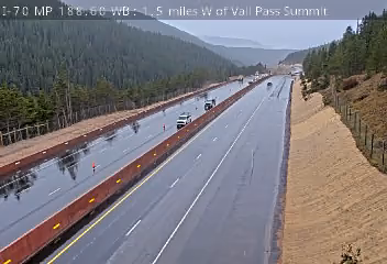
I-70 MP 188.60 WB : 1.5 miles W of Vail Pass Summit - MM 188.6
I-70 MP 187.80 EB : 2.1 miles W of Vail Pass Summit - MM 187.8
I-70 MP 187.25 WB : 2.6 miles W of Vail Pass Summit
I-70 MP 186.80 WB : 3.1 miles W of Vail Pass Summit - MM 186.8
Vail CO · 20 cams I-70 MP 186.35 EB : 3.3 miles W of Vail Pass Summit
looking east I-70 MP 186.10 EB : 3.5 miles W of Vail Pass Summit - MM 186.1
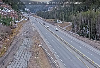
I-70 MP 185.60 WB : 4.2 miles W of Vail Pass Summit - MM 185.6
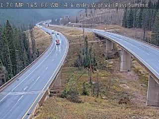
I-70 MP 185.00 WB : 4.8 miles W of Vail Pass Summit
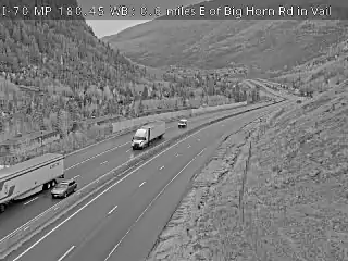
I-70 MP 183.65 EB : 4.5 miles E of Big Horn Rd in Vail
I-70 MP 182.80 EB : 2.6 miles E of Big Horn Rd in Vail - MM 182.8
I-70 MP 182.15 WB : 2.2 miles E of Big Horn Rd in Vail
I-70 MP 180.45 WB : 0.6 miles E of Big Horn Rd in Vail
I-70 MP 179.90 WB at Big Horn Rd in Vail - MM 179.9
I-70 MP 178.65 EB at East Vail Chain Station
I-70 MP 178.45 EB at East Central Vail Chain Station
I-70 MP 178.20 EB at West Central Vail Chain Station - MM 178.2
I-70 MP 177.90 EB at West Vail Chain Station - MM 177.9
I-70 MP 175.85 WB : 0.3 miles W of Vail Rd
I-70 MP 175.30 EB : 1.0 mile W of Vail Rd - MM 175.3
I-70 MP 173.65 WB : 0.4 miles E of Charmonix Rd in Vail
I-70 MP 172.10 WB : 1.0 mile E of Dowd Junction - MM 172.1
I-70 MP 171.75 WB : 0.7 miles E of Dowd Junction
I-70 MP 171.10 EB at Dowd Junction - MM 171.1
I-70 MP 170.45 WB : 0.8 miles W of Dowd Junction
Eagle CO · 2 cams I-70 MP 169.55 EB : 0.9 miles E of US 6 in Eagle
I-70 MP 168.95 WB at US 6 in Eagle
166 .7
Avon Rd looking west I-70 MP 166.65 WB at Avon Rd
166 .0
Avon Rd looking west I-70 MP 165.95 WB : 0.9 miles W of Avon Rd
162 .9
Beard Creek Rd looking west I-70 MP 162.85 WB at Beard Creek Rd in Edwards
160 .2
Wilmore Lake looking west I-70 MP 160.15 WB at Wilmore Lake
158 .1
131 CO 131 looking west I-70 MP 158.10 WB : 1.8 miles E of CO 131 - MM 158.1
157 .1
131 CO 131 looking west I-70 MP 157.10 WB : 0.7 miles E of CO 131 - MM 157.1
156 .6
131 CO 131 looking west I-70 MP 156.60 WB at CO 131 - MM 156.6
155 .8
131 CO 131 looking west I-70 MP 155.80 WB : 0.9 miles W of CO 131 - MM 155.8
Eagle CO · 2 cams 154 .2
131 CO 131 looking east I-70 MP 154.20 EB : 2.8 miles W of CO 131 - MM 154.2
⋮ 8 mi 145 .8
Eby Creek Rd looking east I-70 MP 145.80 EB : 1.0 mile W of Eby Creek Rd - MM 145.8
⋮ 6 mi 139 .6
Trail Gulch Rd looking east I-70 MP 139.55 EB at Trail Gulch Rd in Gypsum
137 .1
Trail Gulch Rd looking east I-70 MP 137.05 EB : 3.0 miles W of Trail Gulch Rd in Gypsum
I-70 MP 134.05 WB at US 6 in Dotsero
133 .4
Colorado River Rd looking west I-70 MP 133.35 WB at Colorado River Rd
133 .3
Dotsero Truck Parking looking west I-70 MP 133.25 WB at Dotsero Truck Parking
132 .3
Colorado River Rd looking east I-70 MP 132.30 EB : 1.3 miles W of Colorado River Rd in Dotsero - MM 132.3
131 .0
Colorado River Rd looking west I-70 MP 130.95 WB : 3.0 miles W of Colorado River Rd in Dotsero
I-70 MP 128.80 EB : 0.2 miles E of Bair Ranch Rest Area - MM 128.8
I-70 MP 128.10 WB : 0.5 miles W of Bair Ranch Rest Area - MM 128.1
I-70 MP 123.15 EB : 2.2 miles E of Grizzly Creek
I-70 MP 122.50 WB : 1.5 miles E of Grizzly Creek - MM 122.5
I-70 MP 120.85 WB : 0.2 miles W of Grizzly Creek Rest Area
I-70 MP 118.70 EB at No Name Lane - MM 118.7
I-70 MP 118.25 EB : 0.3 miles E of No Name Tunnel
I-70 MP 117.65 WB at W No Name Tunnel
116 .9
Grand Ave looking east I-70 MP 116.85 EB : 0.4 miles E of Grand Ave in Glenwood Springs
looking east I-70 MP 116.60 EB at Grand Ave in Glenwood Springs - MM 116.6
I-70 MP 116.20 EB : 0.4 miles W of CO 82 in Glenwood Springs - MM 116.2
looking east I-70 MP 115.95 EB : 0.8 miles W of CO 82 in Glenwood Springs
⋮ 7 mi 109 .0
Canyon Creek Rd looking west I-70 MP 108.95 WB at Canyon Creek Rd in Glenwood Springs
Silt CO · 1 cam ⋮ 13 mi 96 .4
9th St looking east I-70 MP 096.40 EB : 1.2 miles W of 9th St in Silt - MM 96.4
⋮ 10 mi I-70 MP 086.10 EB : 0.8 miles W of US 6 in Rifle - MM 86.1
⋮ 11 mi 74 .7
215 CO 215 looking east I-70 MP 074.65 EB at CO 215 in Parachute
looking west I-70 MP 074.65 EB at CO 215 in Parachute
⋮ 12 mi 62 .8
Roan Creek Rd looking west I-70 MP 062.80 WB : 1.5 miles E of Roan Creek Rd in De Beque - MM 62.8
⋮ 8 mi 54 .4
Beavertail Tunnel looking west I-70 MP 054.40 WB : 3.8 miles E of Beavertail Tunnel - MM 54.4
⋮ 11 mi I-70 MP 043.75 EB at US 6 in Palisade
⋮ 11 mi 32 .4
Horizon Dr looking east I-70 MP 032.35 EB : 1.1 miles E of Horizon Dr in Grand Junction
⋮ 7 mi I-70 MP 025.50 EB at US 6/I-70BL in Grand Junction - MM 25.5
23 .1
River Rd looking east I-70 MP 023.10 EB : 2.7 miles W of River Rd in Grand Junction - MM 23.1
looking west I-70 MP 023.10 EB : 2.7 miles W of River Rd in Grand Junction - MM 23.1
Loma CO · 4 cams ⋮ 8 mi I-70 MP 015.00 WB at CO 139 in Loma
looking north I-70 MP 015.00 WB at CO 139 in Loma
looking west I-70 MP 015.00 WB at CO 139 in Loma
14 .7
Loma Port of Entry looking west I-70 MP 014.70 EB at Loma Port of Entry - MM 14.7
 JamJumper